
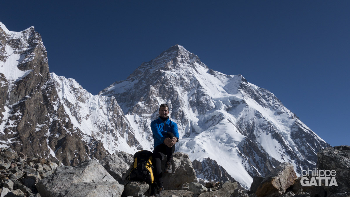
K2 EXPEDITION (8,611 M)
KARAKORAM, PAKISTAN
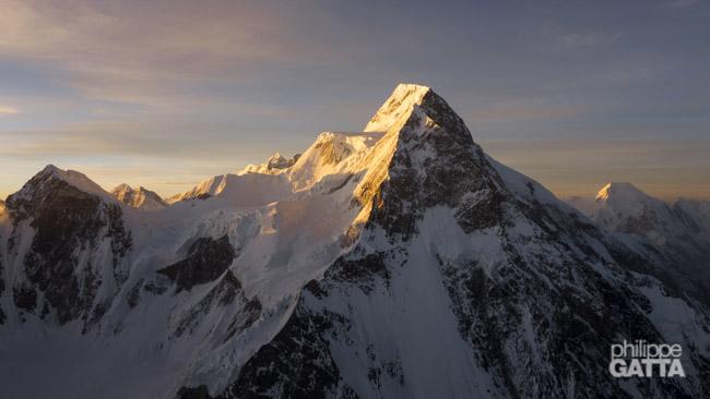
K2, the world’s second highest peak, is located on the Pakistan-China border in the Karakoram Range. Despite Mount Everest’s height, K2 is known as one of the toughest of the fourteen 8000m peaks. This is due to its high altitude, the challenging weather conditions of the Karakoram and the difficulty of the routes.
Italian mountaineers Lino Lacedelli and Achille Compagnoni first climbed K2 in 1954. The ascent was made possible by the efforts of Walter Bonatti and Pakistani porter Amir Mehdi, who carried oxygen bottles to Lacedelli and Compagnoni for their summit day.
The most climbed route today is the Abruzzi Spur (South East Ridge), named after Italian explorer Prince Luigi Amedeo, Duke of Abruzzi, who attempted to climb it in 1909.
As of 2011, over 300 climbers reached K2’s summit, but more than 80 died, making it one of the deadliest 8000m peaks.
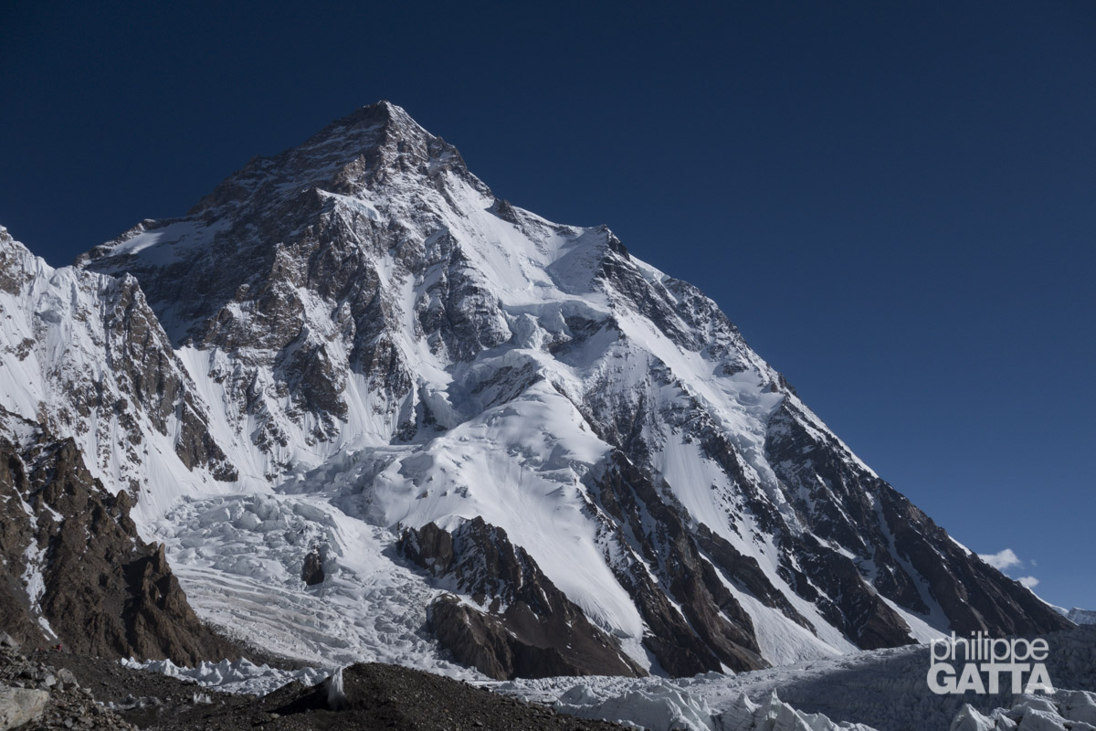
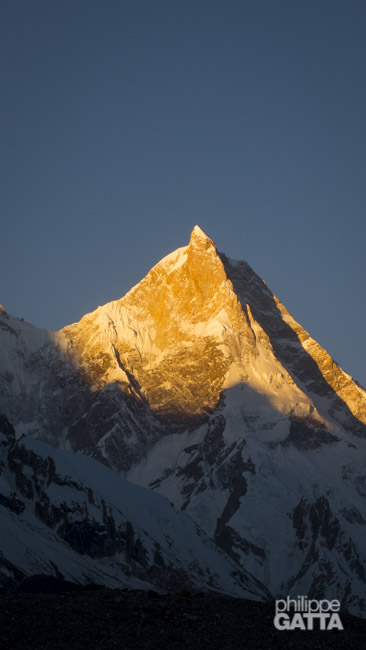
K2 (8,611 m)
Abruzzi Spur route description
The base camp (BC) is located on the Godwin Austin glacier at around 5,000 meters. Then, from the BC, the route goes up on the Godwin Austin glacier, crosses a short icefall to reach the base of Southeast Ridge. The advanced base camp (ABC) is set at 5,300 m (4.5 km from BC). This camp is more a gear depot than a real camp.
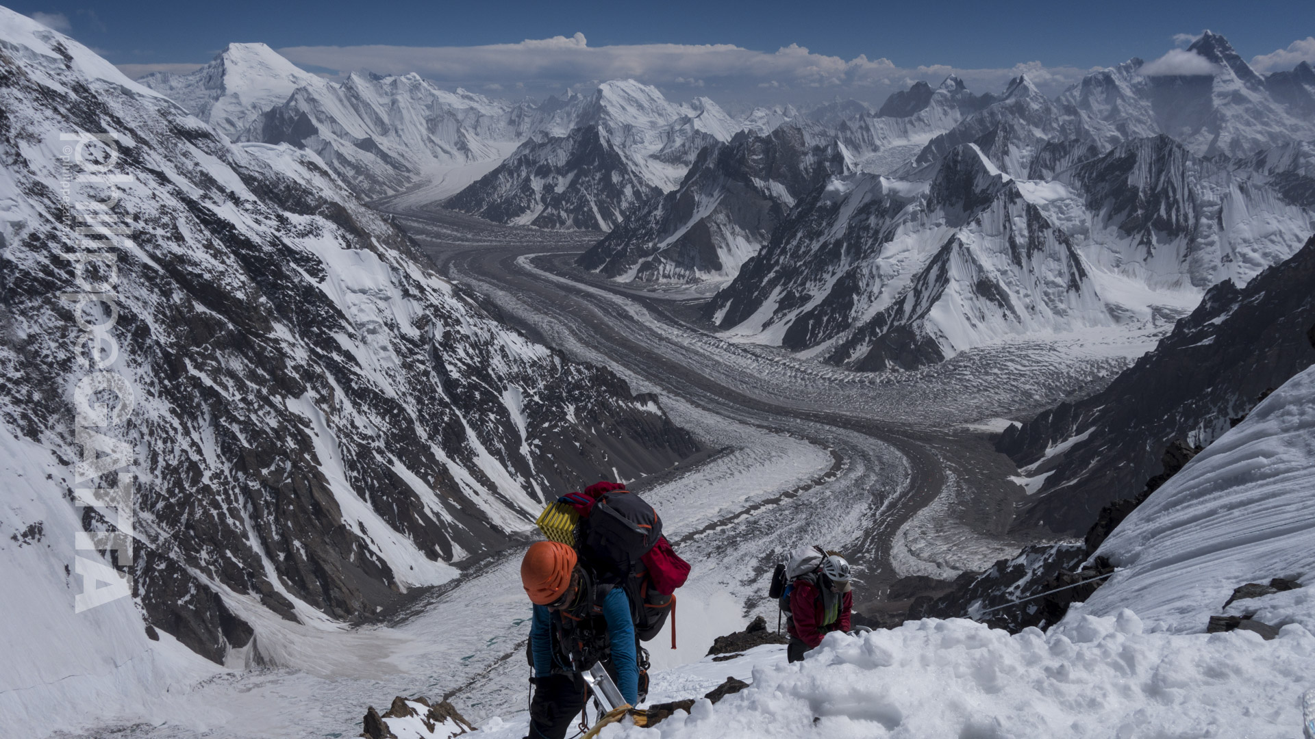
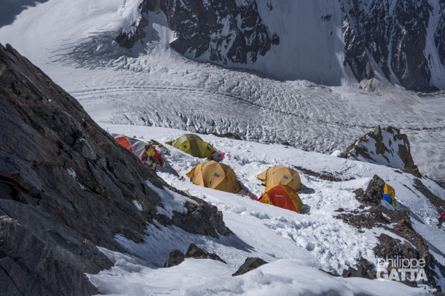
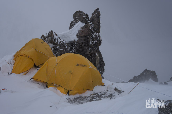
The Abruzzi Spur starts above ABC and climbs a 45° to 65° slope up to Camp 1. Camp 1 is set on a small rocky ridge at 6,050 m which is exposed to rock falls and avalanches. Generally, it takes around 4.5 hours from BC to C1.
Higher, the route continues through snow slopes and rock ridges to the 30m high House’s Chimney (at 6,600 m) which is the hardest section between C1 and C2. Above the chimney, there are less than 100 m to reache C2. C2 is located on a small place at 6,700 m, it is exposed and very windy but safer than C1.
Above C2
Afterwards, some snow slopes and ridges lead to the hardest section of the route; the 400 m of the Black Pyramid. A steep mixed terrain with some vertical cliffs. The camp 3 is set just above the Black Pyramid at 7,400 m. The spot is a bit larger than C1 and C2 but it is very exposed to avalanches.
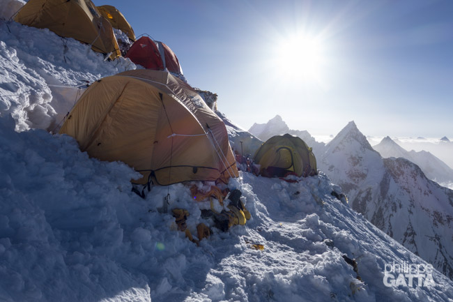
After C3 up to C4, the route is mainly a 30-40° snow slope up to the shoulder (avalanche prone). The Shoulder is a wide, low angle part of the ridge starting at 7,700 m. There are several places to set the C4 on this Shoulder, the best is around 7,950 m. The C4 is relatively safe but very exposed to the high winds. From C4, the slope gets progressively steeper and ends at the Bottleneck, a narrow and steep 80° couloir underneath a massive serac.
Lastly, on the top of the bottleneck, the route traverses to the left (55° slope). Soon after this traverse, the route continues more or less straight up to the top.
K2 summit, 8611
Camp 4, 7950 m
Camp 3, 7400 m
C2, 6700 m
Black Pyramid
Base camp, 5000 m
C1, 6050 m
Bottleneck, 8200 m
K2 – Abruzzi Spur route (© P. Gatta)
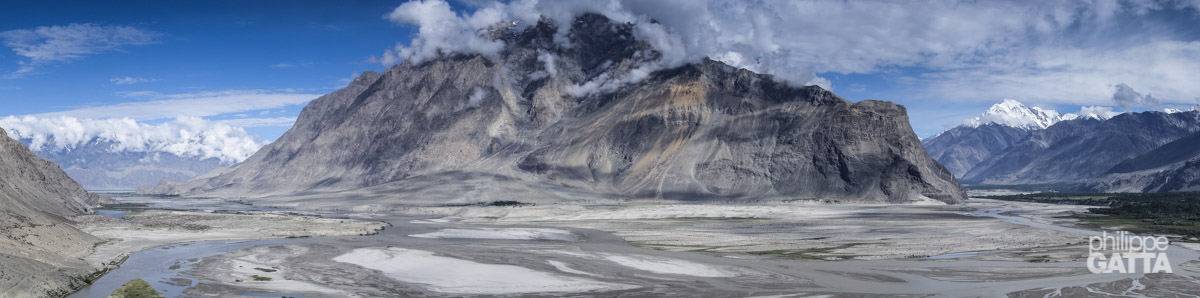
Reaching K2 base camp
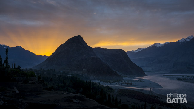
From Islamabad to Skardu along the Karakoram Highway
Our challenge began well before we even arrived at K2. Securing the climbing permit proved to be quite an ordeal, and after being stranded in Islamabad for a time, we were thrilled to finally receive it and begin our ascent.
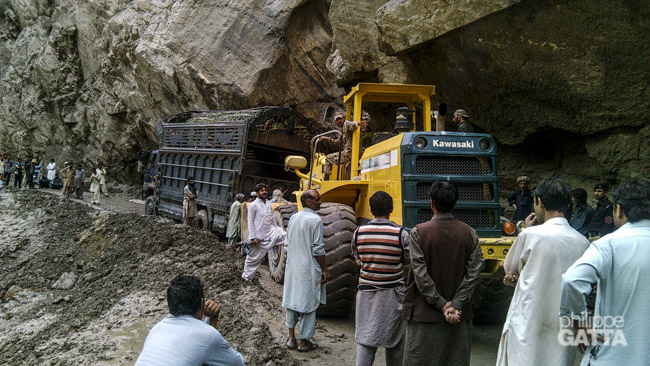
Unfortunately, while flights between Islamabad and Skardu exist in theory, they are frequently cancelled in practice. As a result, we were forced to take the treacherous Karakoram Highway (KKH) to reach our destination. Despite its name, the KKH is anything but a proper highway, with frequent landslides and rockfalls making travel perilous. We also had to navigate dangerous areas close to the Taliban.
Eventually, we set out from Islamabad in a convoy of four buses, accompanied by our friends from the Broad Peak expedition. This presented a wonderful opportunity to catch up with old acquaintances from past expeditions.
While the first leg of the journey was manageable, temperatures exceeding 35 degrees Celsius made it uncomfortably hot, and there was no air conditioning to provide relief. It took us approximately 7-8 hours to reach Besham. Overall the road was good and there were no worries when we crossed the villages as opposed to 2009. Thankfully, there was more security this time around, with military personnel safeguarding the hotel where we stayed.
From Besham to Skardu
We departed early in the morning on the 28th, under the protection of the military. Two jeeps with armed guards flanked our bus, and there was even a man carrying a Kalashnikov on board with us. However, unlike in 2009, I did not feel as though my safety was in jeopardy. The road itself has improved significantly, with many new paved sections and ongoing construction projects, all funded by the Chinese.
Despite the improvements, the road remains perilous due to its location in steep gorges. Many sections are vulnerable to rock falls and sheer drops. The stretch of road between Besham and Chilas was particularly challenging. This area is scorching hot, situated at an average altitude of 1000m and surrounded by brown cliffs and rocks.
Around midday, the temperature soared to approximately 35-40°C, and we sweltered in the bus. The scenery was somewhat bleak: dry, rocky, and sandy, with the Indus river winding through the valley. The only respite was catching a glimpse of Nanga Parbat in the distance, framed by sand dunes.
After 21 grueling hours on the bus, we finally arrived in Skardu. It was hardly the ideal preparation for our upcoming mountain expedition.
Trekking to K2 Base Camp
July 1: Skardu - Askole (2,950 m)
The drive from Skardu to Askole took 6 hours and went rather well. One bridge was too damaged to be used by the Jeep so we swapped Jeeps after the bridge.
Askole is a nice small village, the last one in the valley.
July 2: Askole - Jhula (3,160 m)
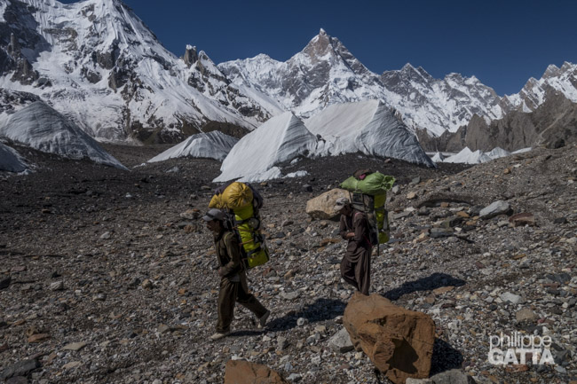
The logistics for our expedition were shared with the Broad Peak team, which meant that we had a total of 400 porters at our disposal. We set off at 6am, taking advantage of the cool morning air before the temperature began to rise.
The weather was fantastic, and the views were breathtaking. The trail followed a wide river with sandy banks, flanked by towering hills and snow-capped mountains. Our first stop was at Jhula, a dusty and rather unpleasant campsite, and not the most enjoyable spot on our trek.
Stage: 20 km, +390m/-260m, 3h55.
July 3: Jhula - Paiju (3,450 m)
We departed from Jhula at 6 am, an hour after other teams and porters, which made the trail slightly busier. The initial hour was comfortable in the shade, but then the heat returned. However, I maintained a steady pace, overtaking all the porters carrying their impressive 25kg load. Knowing the route and having a GPS made it easier to manage my effort, and the sandy and dusty terrain reminded me of desert races, making me tempted to run.
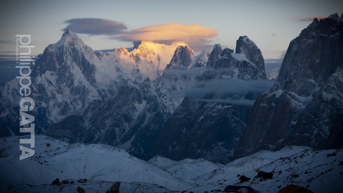
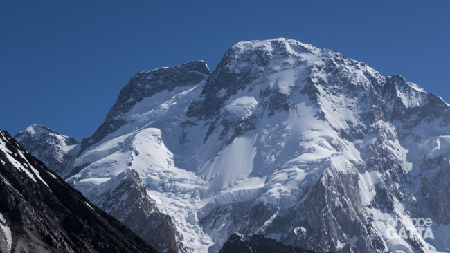
During the later part of the day, we witnessed the first glimpse of K2, the only peak with a plume and high wind at the summit. I arrived at Paiju, located at an altitude of 3450m, in 4 hours and 15 minutes, feeling good. Paiju is one of the few places on the trail with trees, providing a break from the scorching sun.
Stage: 20 km, +505m/-290m, 4h10.
July 4: rest day in Paiju (3,450 m)
Today was a rest day for the porters so we all stayed in Paiju.
July 5: Paiju - Urdukas (4,050 m)
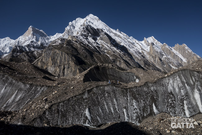
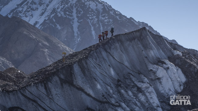
The first hour after Paiju was a breeze, but things quickly became challenging as we began to trek on the Baltoro moraine. The trail was quite rough, with numerous unstable rocks, and required us to traverse ups and downs for 19km while gaining 1,000 meters in elevation. This particular day was likely the toughest of the entire trek to Base Camp.
Despite the difficulties, we eventually arrived at Urdukas camp, which was situated in a picturesque location with breathtaking views of the Trango Tower.
Stage: 19 km, +1000m/-380m, 4h45.
July 6: Urdukas - Goro 2 (4,300 m)
Early the next morning, we departed from Urdukas and resumed our trek on the Baltoro glacier, with its relentless ups and downs. However, we were blessed with perfect weather conditions, which afforded us breathtaking views of Gasherbrum IV and Masherbrum.
Eventually, we arrived at Goro 2, situated at the heart of the glacier at an altitude of 4,300 meters. We set up our campsite there and prepared for the next stage of our journey.
Stage: 12 km, +535m/-305m, 3h10.
July 7: Goro 2 - Broad Peak BC (4,700 m)
Despite its challenges, the trek also had its rewards, particularly when the weather was favorable, providing us with breathtaking views. During our 19-kilometer hike, we were surrounded by some of the world’s most awe-inspiring mountains, including Muztagh Tower, Mitre Peak, Gasherbrums, Broad Peak, and K2. We eventually pitched our campsite near Broad Peak, at the heart of the Godwin Austin glacier.
Stage: 19 km, +680m/-250m, 5h.
July 8: Broad Peak BC - K2 BC (5,000 m)
Today’s walk was short with the massive face of K2 constantly in front of us. Finally we arrived early and spent the rest of the day setting up our base camp.
Stage: 6 km, +250m/-40m, 1h10
The K2 climb
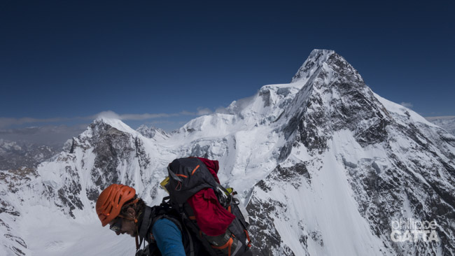
July 9-11: first rotation to K2 camp 1 (6,050 m)
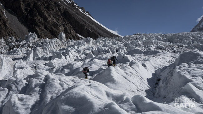
After a first round trip to advanced base camp (5,300m), we made our first rotation to camp 1 (6,050 m). The objective of the rotations was to get acclimatized to the high altitude and carry all the loads (gear, food, clothes, tent, etc.) to the high camps.
Eventually we reached advanced base camp (ABC) in 2 hours. The 4.5 km walk on Godwin Austin glacier was not too bad and the icefall is relatively short. From ABC, the slope gets steeper (30 to 60 degrees) and with the heavy pack, it took me 3 hours to get to C1.
We spent one cold and windy night there and went back down to base camp (2h30).
July 12-13: rest day at K2 base camp
Time to rest and recover after the first rotation and get ready for the second one.
July 14-17: second rotation up to 6,900m
July 18-23: waiting game at K2 BC
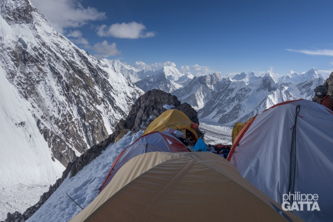
We left BC early in the morning to avoid the avalanches and rock falls caused by the unusual high temperatures. Then I went straight to camp 1 that I reached in 4h30, thanks to a better acclimatization.
The following day, we climbed the famous House’s Chimney and reached camp 2 in the morning, in 3h15 from C1.
We spent a first night at 6,650 m. Next day, I climbed to 6,900m on the Black Pyramid and went back down to C2 for a second night.
We made our way back to base camp after spending 3 days at high altitude. We had to descend 1,700 meters and it took us about 3 hours and 15 minutes to get from Camp 2 to base camp. During the descent, we left all of our equipment in Advanced Base Camp.
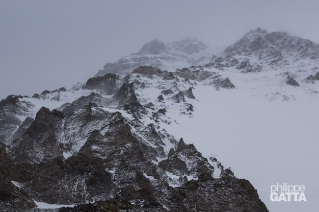
Upon returning to BC, we were eager to start our summit push, but unfavorable weather conditions dashed our hopes.
The same heat wave that claimed the lives of 2,000 people in Pakistan also affected the mountain.
We wore summer clothing even at 5,000 m altitude, while the freezing level rose to 7,000 m. Every day, we encountered numerous avalanches and rockfalls, and even witnessed running water at an elevation of 6,000 m!
Tragically, one of these avalanches struck Broad Peak, resulting in the death of a porter and injury of three climbers.
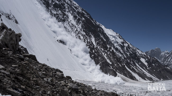
Two massive avalanches destroyed our camps. We lost all our climbing gear and tents.
July 24-26: K2 summit attempt
The anticipated good weather never arrived and the weather forecasts were frequently changing. A massive avalanche descended from 7,000 m to the glacier, bringing down human remains.
Despite the bad news, we resolved to attempt the summit. As the weather window was too brief for a regular summit push, we chose to proceed straight from BC to C2, with the aim of summiting on the 27th.
Sadly, a huge avalanche wiped out our advance base camp, taking with it all our climbing gear such as crampons, ice axes, harnesses, helmets, etc. We began digging desperately with whatever tools we could muster at the time – a couple of ice axes and a frying pan. Gradually, we received more assistance and shovels, but the task was monumental and avalanches continued to fall.
Even after three days of digging, we were only able to recover a portion of our equipment. The loss of equipment and the unfavorable weather forecast put an end to all expeditions.
July 27-Aug 6: trekking back and return to Islamabad
We trekked back to Askole in 4 days and finally reached Islamabad 5 days later, after another epic experience on the Karakoram Highway.