
KHAN TENGRI (7,010 M / 22,999 FT), WEST RIDGE
TIAN SHAN, KYRGYZSTAN
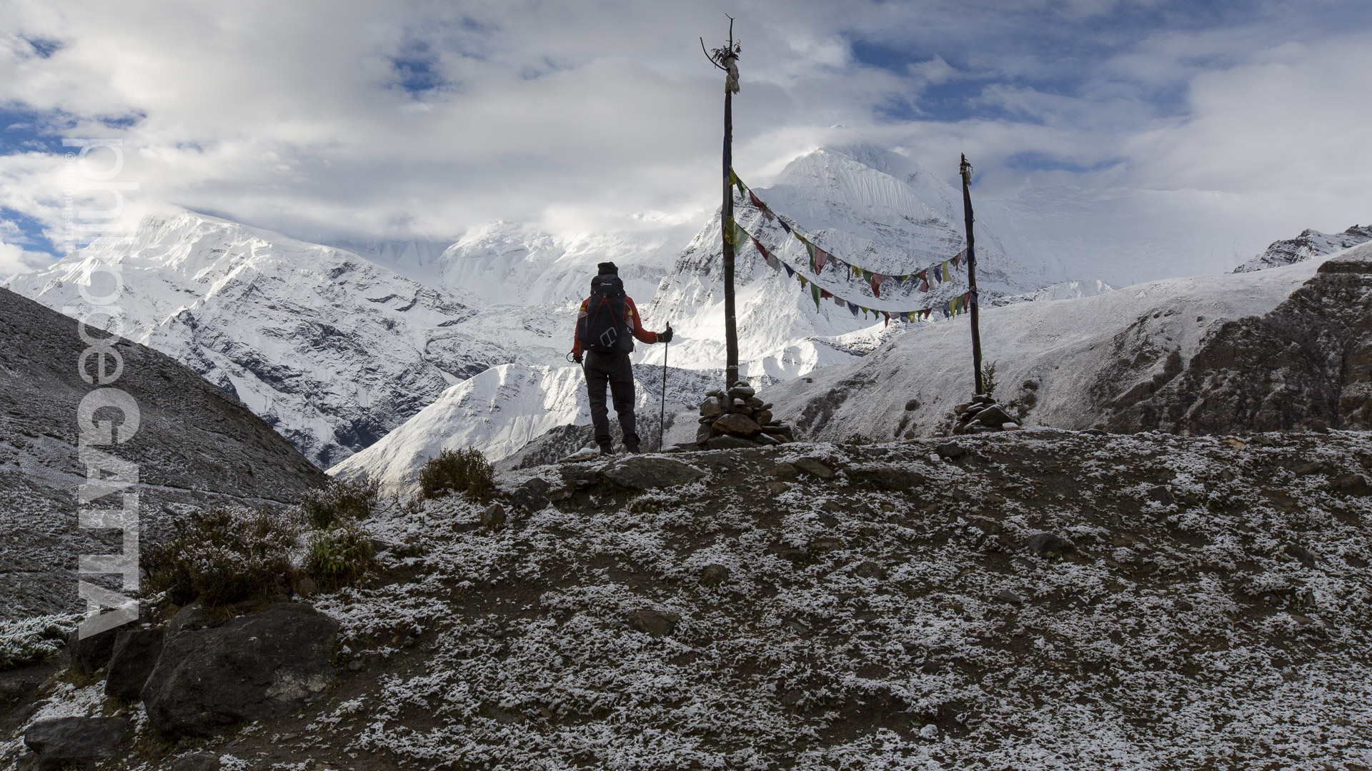
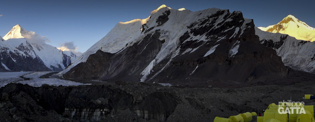
The Peak Khan Tengri is the second highest mountain in the Tian Shan mountain range, standing at an elevation of 7,010 meters. This mountain range is situated in Central Asia, towards the north and west of the Taklamakan Desert (Xinjiang province, China).
The Tian Shan range is connected to two other mountain ranges: the Pamir towards the south and the Altai Mountains of Mongolia towards the northeast. Among the highest peaks of the Tian Shan, Jengish Chokusu (7,439 m, also known as Peak Pobeda or Peak Victory) and Khan Tengri (7,010 m) stand out.
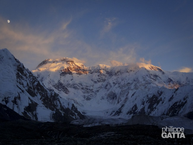
Khan Tengri lies further north than Jengish Chokusu, on the border of China, Kyrgyzstan, and Kazakhstan, to the east of Lake Issyk Kul (the tenth largest lake in the world by volume and the second largest saline lake). It is also the world’s most northern peak with an elevation of 7,000 meters and is renowned for its challenging weather conditions.
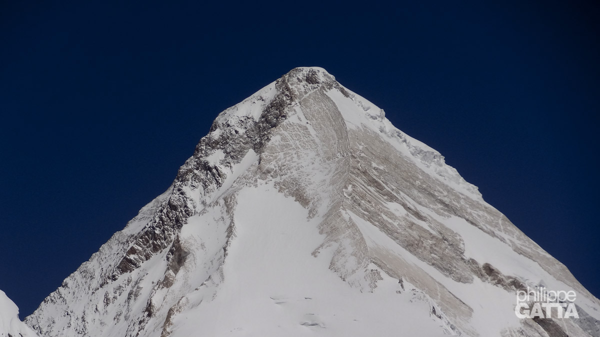
Khan Tengri: South Face and West ridge
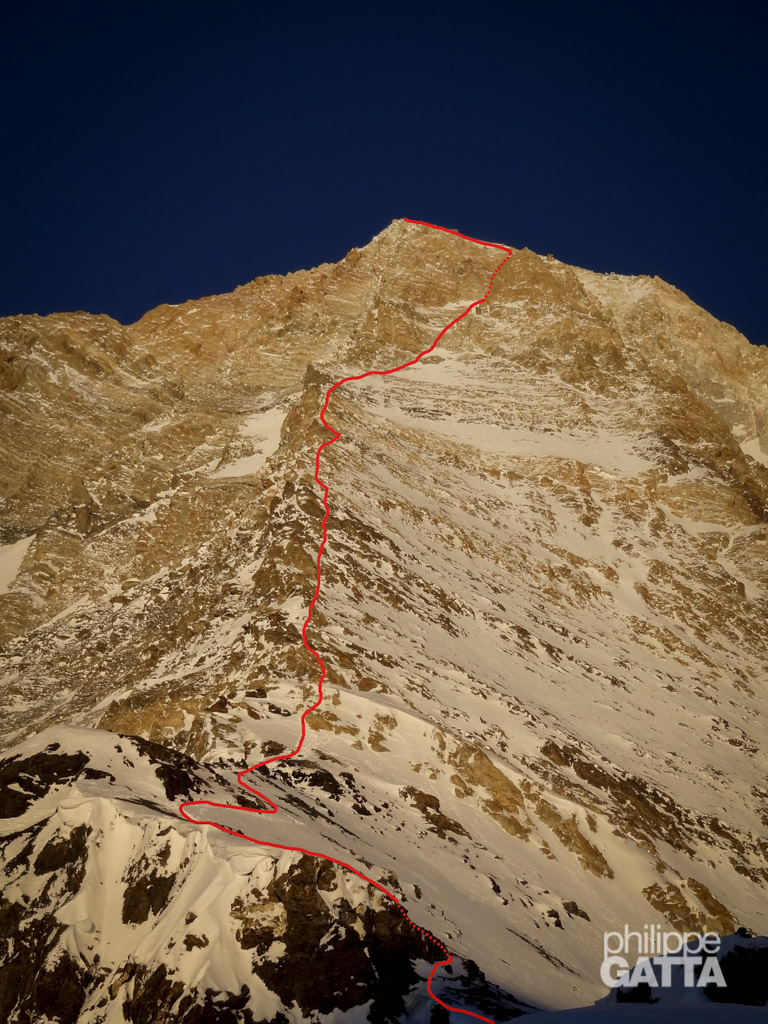
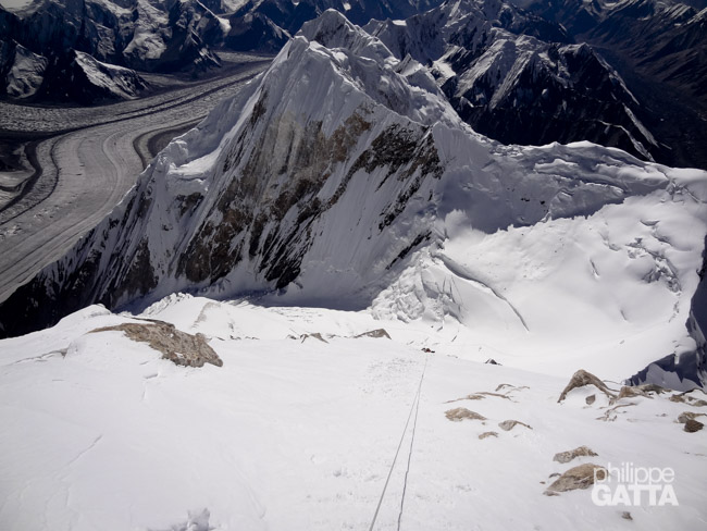
Philippe and Yannick climbed the Progrebietsky route on the South Face and West ridge of Khan Tengri. The route is rated AD+ or Russian 5a. The base camp is located on the South Inylchek glacier at 4,050 m. Then they set three high camps at 4,300 m, 5,300 m and 5,900 m.
From the camp 1, the route goes up along the Semenovsky glacier. Then it crosses an icefall which starts at 4,900 m, and passes under the exposed slopes of Peak Chapaev.
The camp 2 is above the icefall at around 5,300 m in a relatively safe zone.
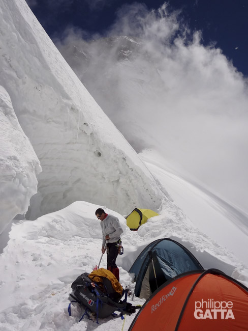
Then from the camp 2, the route continues on easy snow slopes up toward the West Col. The West Col is at 5,900 m and the camp 3 is 50 meters below. There were around eight tents and two snow caves.
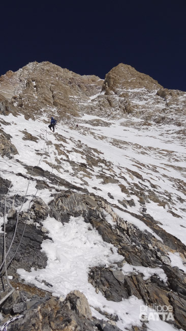
Finally, above the camp 3, there are some steep ice/snow sections (max 60°) and the overall route follows the ridge on a mixed terrain. The crux is a short wall rated UK 5a at 6,700 m. Above, it is a snow ridge up to the top at 7,010 m.
Khan Tengri Express: expedition schedule
Here is the schedule:
- Friday 27 July: we flew from France to Bishkek, Kyrgyzstan
- Saturday 28 July: we landed in Bishkek at 5am and drove to Karkara camp (2,200 m) that we reached at midnight
- Sunday 29 July: we flew by helicopter to the base camp of Khan Tengri
- Monday 30 July: we walked up to camp 1 (4,300 m) and went back to BC
- Tuesday 31 July: we made a load carry to camp 1, continued to 4,750 m and went back to BC
- Wednesday 1 August: rest day at BC
- Thursday 2 – Saturday 4: we went to camp 1 (4,300 m), camp 2 (5,300 m) and camp 3 (5,850 m)
- Sunday 5 August: we summitted Khan Tengri and went back to C3
- Monday 6 August: we went back to BC
- Tuesday 7 – Friday 10 August: we flew from BC to Karkara, drove to Bishkek and flew back to France
Express ascent of Khan Tengri
The expedition started in Bishkek, the capital of Kyrgyzstan. Then we drove 8 hours / 460 km toward the West of Kyrgyzstan; passed along the large Lake of Issyk Kul and finally reached the camp of Karkara at 2,200 m where we spent the first night. From there, we flew by helicopter to the base camp of Khan Tengri.
Day 1: helicopter flight to Khan Tengri Base Camp
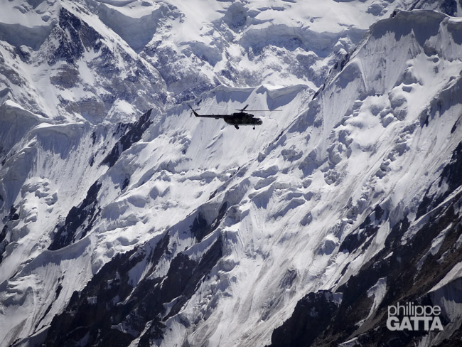
We left the grassy camp of Karkara early in the morning and took a Mi-8 helicopter to the Khan Tengri base camp (BC). The 100 km flight was absolutely stunning with fantastic views over the Tian Shan range.
Heart Rate: 90 bpm, Oxygen saturation: 90%
Day 2: Base Camp (4,050 m) - Camp 1 (4,300 m) - Base Camp (4,050 m)
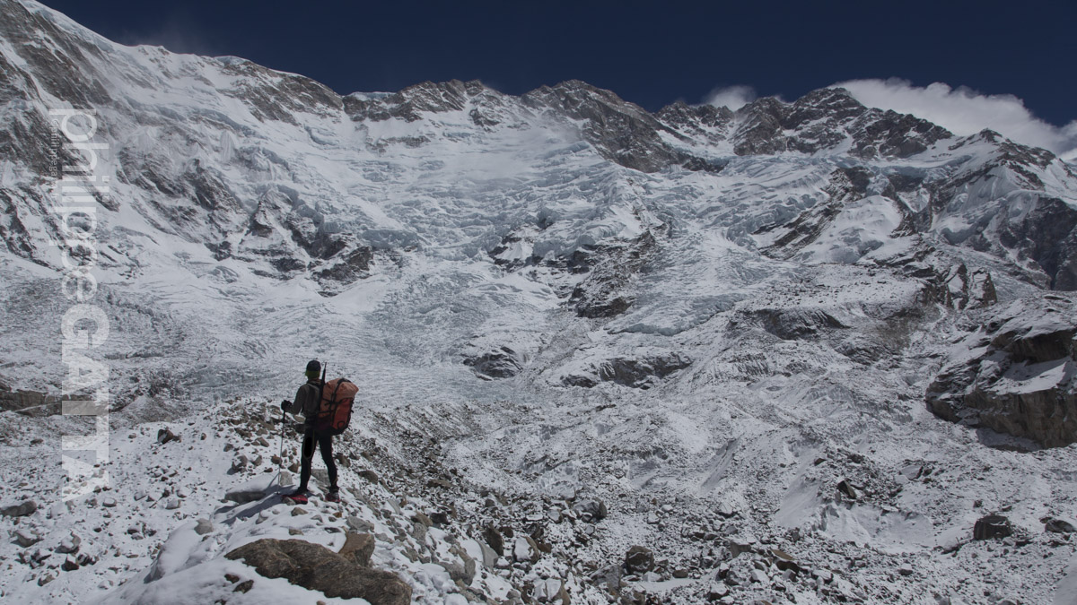
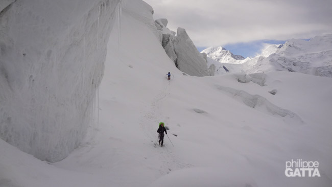
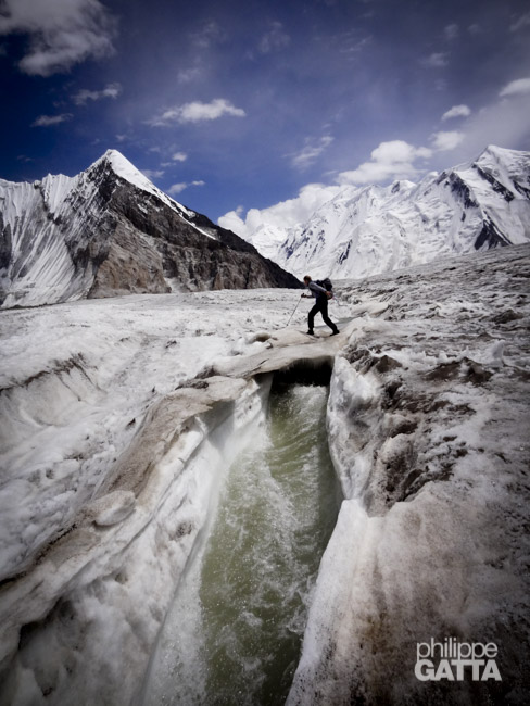
We left the base camp for a short acclimatization walk. We first went to the Tian Shan Travel base camp, 30 minutes away from our base camp, following a trail on an easy moraine. As we felt good, we decided to continue to the camp 1, walking on the huge South Inylchek glacier. There were a very few crevasse and most and them relatively small but there were several ice rivers difficult to cross. We reached the C1 in 2 hours from the BC. The C1 is located at the junction of the Semenovsky and Inylchek glaciers. There were 6.8 km of distance and around 300 meters of elevation gain between the BC and the C1.
BC-C1-BC: 13.5 km, +300 m / -300 m, 3h40.
Heart Rate: 80 bpm, Oxygen saturation: 90%
Day 3: Base Camp (4,050 m) - 4,750 m - Base Camp (4,050 m)
We left the base camp to carry some food, ropes and gear to the camp 1 (2 h). Then we continued half way to the camp 2, at around 4,750 m to see the famous icefall (1h30 from C1). Then we came back to the base camp.
BC-4,750 m-BC: 19 km, +750 m / -750 m, 6h10.
Heart Rate: 80 bpm, Oxygen saturation: 89%
Day 4: Rest day at Base Camp (4,050 m)
It was snowing a bit. We had a rest day at the base camp, preparing the kit and gear for our ascent.
Heart Rate: 74 bpm, Oxygen saturation: 92%
Day 5: Base Camp (4,050 m) - Camp 1 (4,300 m)
As the weather forecast for the following days was good, we left the camp camp for our summit bid. We carried 20 kg pack with all our kit, gear and additional food. With this additional weight, it took us 2h30 to reach the camp 1. A short snow storm came in the afternoon but fortunately the sky cleared up later in the evening.
BC-C1: 6.8 km, +300 m, 2h30.
Heart Rate: 82 bpm, Oxygen saturation: 90%
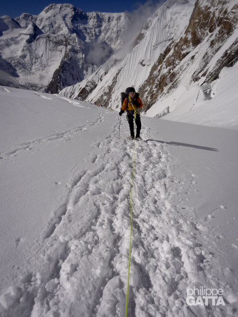
Day 6: Camp 1 (4,300 m) - Camp 2 (5,300 m)
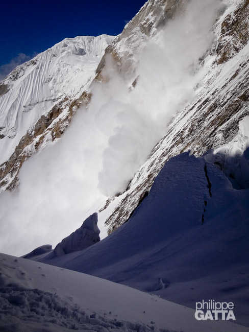
It took us 1h30 to be ready and we left the camp 1 at 4:30am. After, we took the load that we left 2 days ago in addition to what we carried the day before so we ended up with 25 kg pack. Finally, we were the last ones to leave the camp but we progressively passed most climbers before the icefall. Unfortunately 7 climbers were still ahead of us when we reached the 20 meters serac with a fixed rope. They were inexperienced and it took them 2 hours to climb the 20 meters of serac! During this time, we were all exposed to the serac and avalanche from the Peak Chapaev. After the serac, it took us 20 minutes to reach the camp 2, 6 h from C1 if we don’t count the 2 h spent waiting.
C1-C2: 4.5 km, +1,050 m, 6h.
Heart Rate: 75 bpm, Oxygen saturation: 78
Day 7: Camp 2 (5,300 m) - Camp 3 (5,850 m)
With a limited acclimatization and 1,000 m of elevation gain in a day, the night has not been very good. For once, we were the first team to leave the camp 2. Still carrying our 25 kg pack, we headed toward the camp 3 on gentle snow slopes. Then, the temperatures quickly rose when the sun came and it was pretty warm when we reached the camp 3. The tents were set on shelf underneath the big serac of the West Col.
C2-C3: 1.75 km, +550 m, 2h40.
Heart Rate: 81 bpm, Oxygen saturation: 77%
Day 8: Camp 3 (5,850 m) - Khan Tengri Summit (7,010 m) - Camp 3 (5,850 m)
Most teams spend a night there at camp 3 to finish their first acclimatization trip before returning to the base camp. Then they go back up for the summit push after a couple of rest days. That is probably the best way to acclimatize but that also means making two round trips of 26 km and +2,000 m with huge pack… That also means going back and forth in the icefall and under the Chapaev slopes several times.
We decided up front to try to climb to the camp 3, spend a day or two there and continue straight to the summit if we could. Unfortunately the weather forecast was good for only 24 hours so we couldn’t spend another day to rest as planned. However, we felt good and with an Oxygen saturation at 77% we decided to go for the summit.
We woke up at 3am but we were so slow, especially to melt snow, that we left the camp 3 only at 5am. We were the two last climbers to leave the camp.
Then, we progressively passed several climbers. The weather was perfect, with a light wind, -25°C (windchill -31°C). We reached the top of Khan Tengri after 10 hours of climb.
On the top, we spent 30 minutes before starting the descent. With the numerous abseil it took us 4h40 minutes to get back to the camp 3.
C3-Summit: 2.5 km, +1,200 m, 10h.
Summit-C3: 2.5 km, -1,200 m, 4h40.
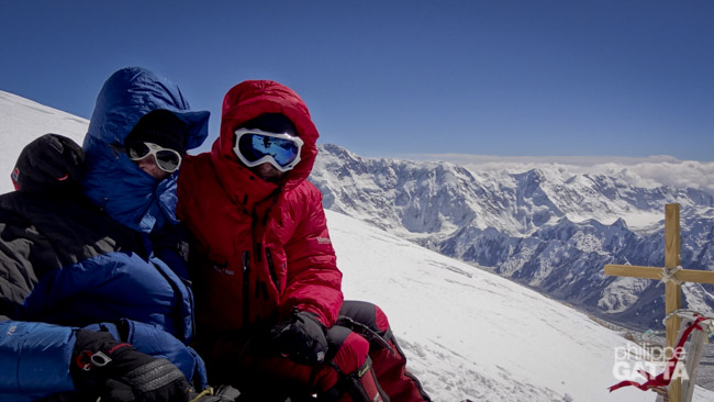
We reached the top of Khan Tengri after 10 hours of climb. We spent 30 minutes on the top and started the descent.
Day 9: Camp 3 (5,850 m) - Base Camp (4,050 m)
The night has been short nad we are still tired by the 15 hours climb of the previous day. We packed everything, cleaned up the tent, gathered our rubbish and headed down.
Later, we made a quick stop to the camp 2 to gather the extra food and rubbish we left there and continued our descent with big packs once again.
Then, we made a last stop at camp 1 to pick up the gear left there too. We finally reached the base camp after 6 hours, right on time for the lunch.
C3-BC: 13 km, -1,900 m, 6h.
Day 10-12: return to France
After our return to the base camp the weather changed and it started snowing. With the fatigue of the ascent, the ridiculously small amount of food at base camp, the changing weather and the few days left, it was clear that we didn’t have much chance to summit Podeba so we decided go back home. We waited for the helicopter a couple of days and went back to France in just a few days, thanks to a good logistic.