MADAGASCAR Running RACE
250KM IN THE NORTH OF MADAGASCAR
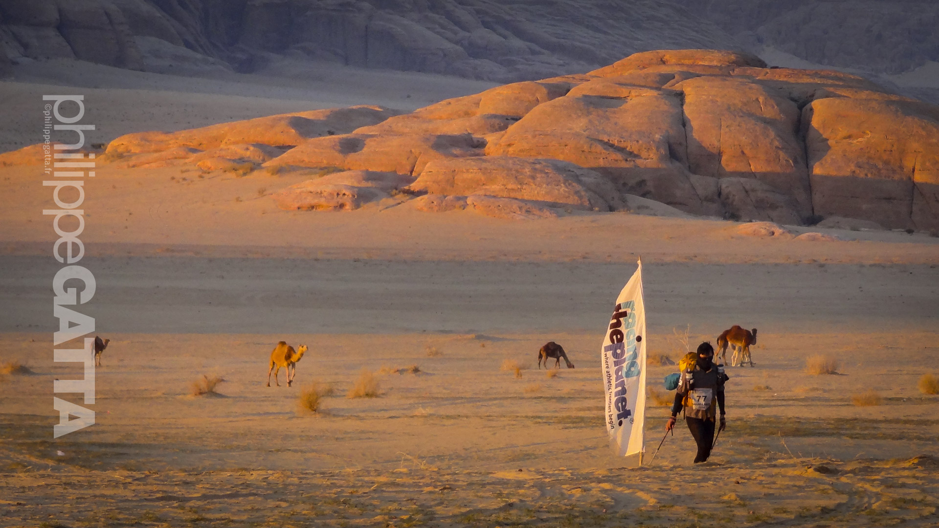
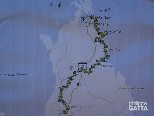
The Madagascar Race is a 250 km (155 miles) running race which is part of 4 Deserts Roving Race series. This edition started in the north of Madagascar, close to the city of Antsiranana and went South – Soutwest to finish at the city of Ambilobe. There were 6 stages in 7 days: almost 4 Marathons in 4 days, then 77 km, a rest day and a final stage of 10 km.
The rules
The Madagascar Race is a self-supported event, which implies that participants must carry all their belongings, including equipment, clothing, sleeping bags, medical kits, and seven days’ worth of food. RacingThePlanet only provides water and tents for overnight stays.
Moreover, as per the rules, competitors must bring a minimum of 14,000 calories (2,000 calories per day). However, most participants carry more, such as the writer, who brought approximately 23,000 calories (4.3 kg). In addition, the writer’s pack included clothing, sleeping bags, and a medical and safety kit, totaling 3.5 kg and 7.7 kg without water.
The Madagascar Race’s concept and difficulty are comparable to RacingThePlanet’s other events, such as the Sahara Race, Gobi March, Atacama Crossing, Jordan, Madagascar, and the Last Desert in Antarctica.
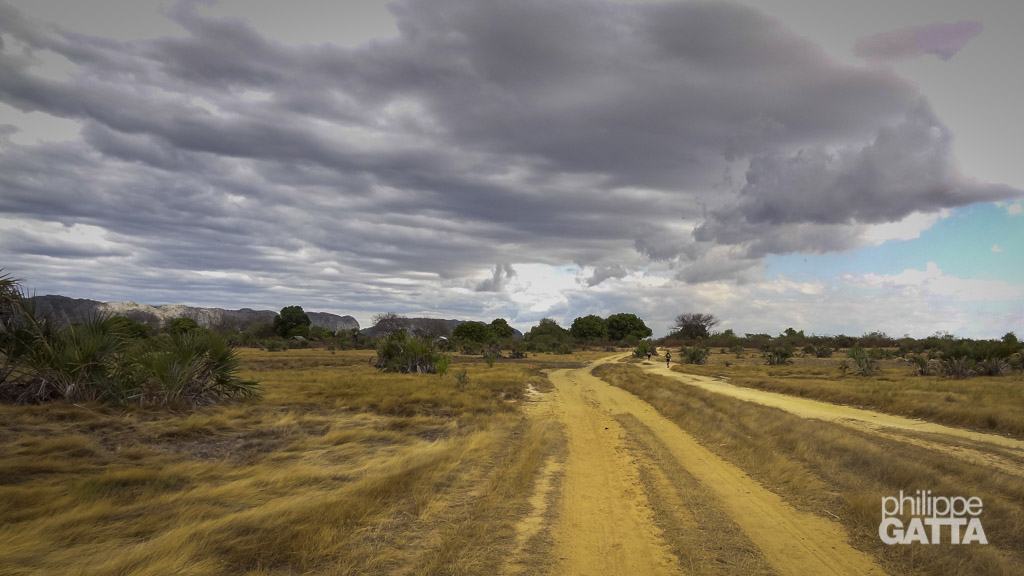
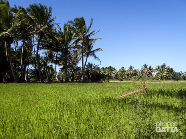
Furthermore, the race features various terrains, including beaches, soft sand, volcanic rocks, Baobab forests, dirt roads, rice fields, and numerous river crossings. The temperatures during the race were approximately 35 degrees Celsius with approximately 60% humidity.
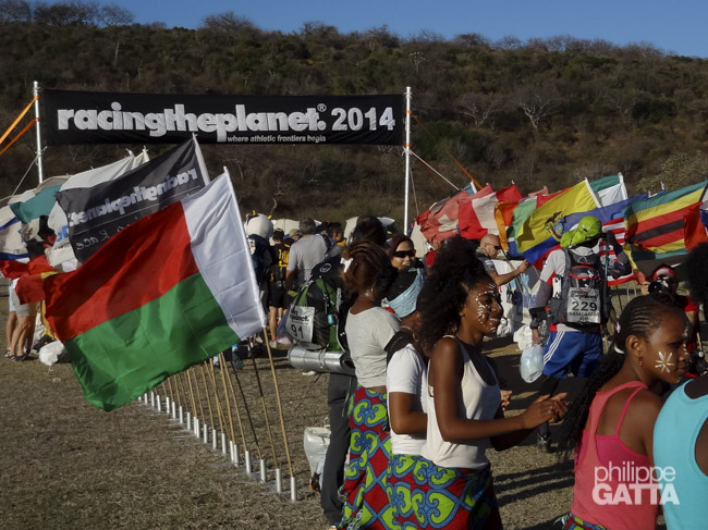
All competitors arrived in Antsiranana, also know as Diego Suarez a couple of days before the race. On Saturday we had the race briefing, equipment review, check-in. Then we went to the first camp in an old military camp from the Legion Etrangere, along a nice sand beach. The race started on Sunday morning and ended the following Saturday.
The Madagascar Race
August 30: Briefing and transfer to Camp 1
The Saturday morning, 234 competitors coming from 43 countries left Antsiranana and arrived in camp 1 after 45 minutes of bus. We have been welcomed by locals and enjoyed the sand beach around.
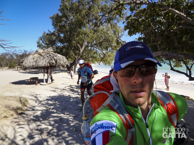
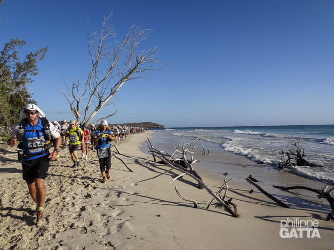
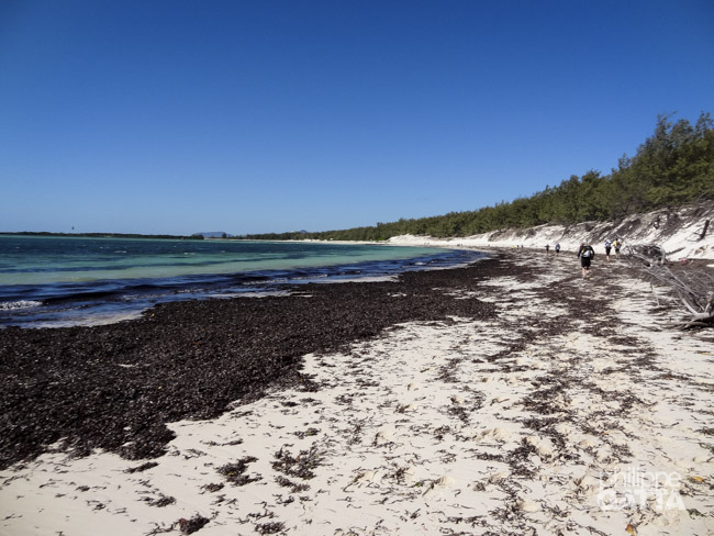
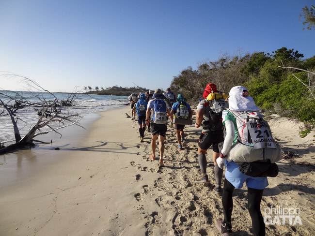
August 31, Stage 1: "Three bays of the Indian Ocean" - 36.7km
After two months spent climbing in Mont Blanc Massif, the transition to a running race on soft sand and by 36 degrees was brutal.
Fortunately the stage was amazing. We crossed three bays and nice white sand beaches. The scenery reminded me a mix of Guadeloupe, La Reunion and Hawaii.
I finished the 40 km in 4:50 hours and is ranked 30/230.
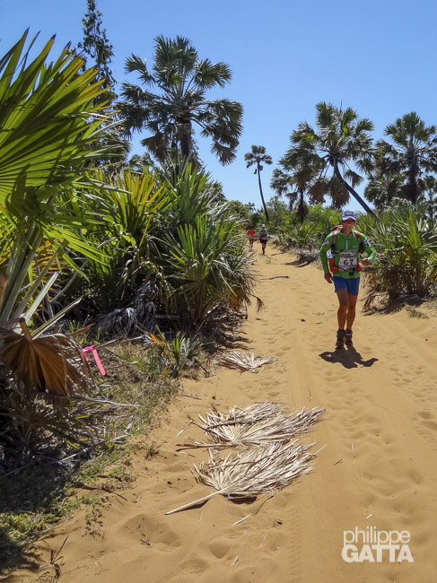
September 1, stage 2: "Path to the Madagascar Baobabs" - 46.8km
The night along the beach was a pleasure for the eyes but the mix of wind, sand and salt was terrible as we could not take a shower.
The heat is difficult to cope with and yesterday my heart rate was at 90% for almost the whole race. So for the second day, 46 km, I calmed down.
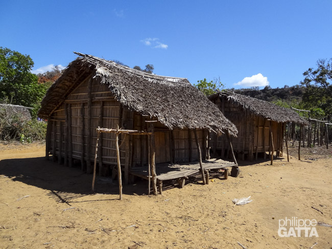
In the first checkpoint I was ranked 60, but I couldn’t care less this stage was the most beautiful one I have experienced within the RacingThePlanet races. White sandy beaches, bushes and the famous baobab trees, coconut palm trees, banana tree forest and rivers.
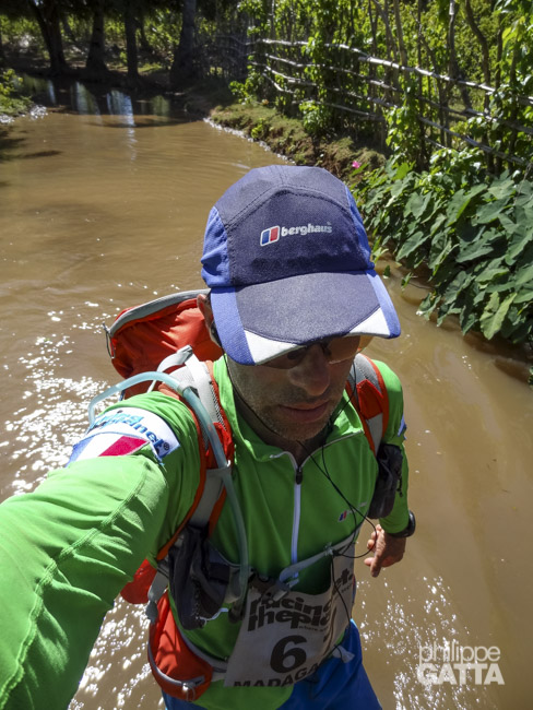
It was very hot and with all the river crossings many runners’ feet were already destroyed.
At the arrival we had hundreds of village people singing for us and cheering it was very touching to be greeted by them.
I lost my way a few times but ended up with a total ranking of 34/230.
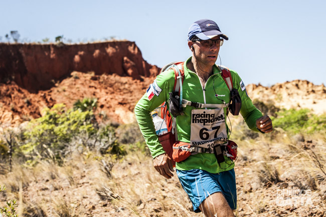
September 2, stage 3: "The red Tsingy valley Madagascar " - 42.1km
I started the third day of the race at a slow pace. However, after reaching checkpoint 1, I felt better and ran the remaining 42 km.
During the race, we covered a new section of 3.5 km along the beach before crossing the Red Tsingy, which resembles a smaller version of Bryce Canyon.
The majority of the terrain comprised dirt roads, which became unbearably hot. Just before reaching the campsite, the runners had to cross a river, where they would have loved to swim if not for the presence of crocodiles.
Despite the challenging conditions, I performed better on the third day and moved up 13 spots in the ranking, reaching 21st out of 230 participants (with 25 abandonments at present).
September 3, stage 4: "Route to the Madagascar Sacred Lake" - 40.3km
Yet another beautiful stage with savanna, lots of dirt roads and small villages…
We ran 3 km around the Sacred Lake with many locals who came to cheer on us and laugh their heads off seeing these 200 idiots running in the 40°C heat!
4th marathon done. I feel better every day, so yet another month and all will be good! The only problem the race is over in a few days…
September 4, stage 5: "The Long March through the Grey Tsingy reserve" - 77km
The stage was beautiful but with such an effort you can’t appreciate anything. Yet many rivers destroying the feet…
The Long March, 77 km, has been a memorable battle, I gave everything. For the first time I have finished a Long March during daytime, finishing after 9:45 hours in 16th position completely wasted! I ran everything.
September 5: rest day
We spent the day resting, talking and having fun.
September 6, stage 6: "The final footsteps to Ambilobe" - 10km
I was worried about these last 10 km as my legs were tired after 240 km and I knew it would go fast. At the same time the guy behind me was 1h after in total ranking so no stress.
Finally the 10 km of dusty track were not too bad and I was happy to pass the finish line of this amazing race.
This was not the hardest race I’ve done but the competitors level was definitely higher than previous 4 deserts races. It has been a pleasure to share these 7 days with 230 fellow runners!
My final ranking is 19/230 with 189 finishing the race.