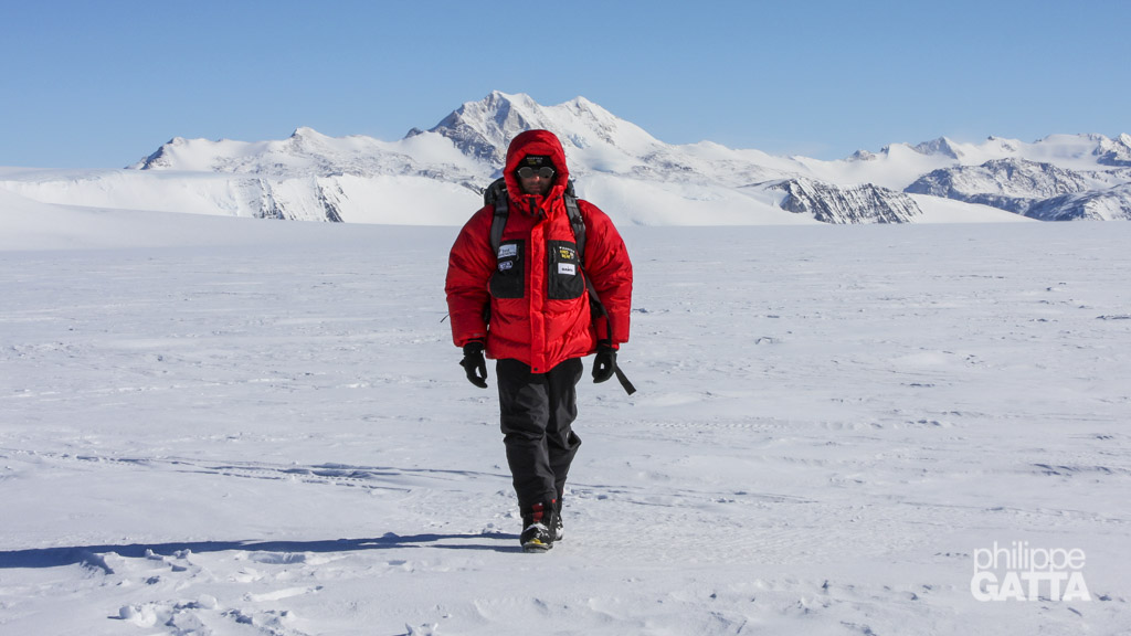
MOUNT VINSON (4892 M / 16,049 FT)
SENTINEL RANGE, ELLSWORTH MOUNTAINS - ANTARCTICA
Mount Vinson
Mount Vinson (or Vinson Massif) is the highest mountain of Antarctica and reaches 4892 m (16,049 ft). It is located in the Ellsworth Mountains Range, only 1,200km (750 mi) away from the South Pole. Temperatures in the Ellsworth Mountains average around -30 °C (-20 °F). The best months for expeditions are December through February.
The massif has been discovered in 1957 and the top reached for the first time in 1966. As of today around 1,000 climbers (only 17 French) have succeeded Mt. Vinson, much less than Mt. Everest.
The Mt. Vinson is part of the 7 Summits Challenge which consists in climbing the highest mountain of each of the 7 continents.
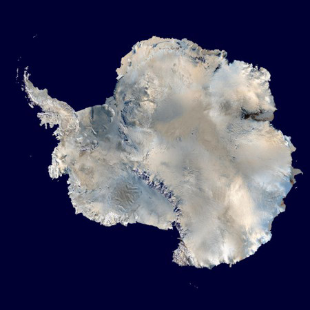
Antarctica
Antarctica is a unique continent, as it is the coldest, driest, and windiest. Additionally, it has the highest average elevation compared to other continents. About 98% of Antarctica is covered by ice, with an average thickness of 1.6 kilometers (1.0 mi) and can reach up to 4.5 km (2.8 mi). This continent holds approximately 90% of the world’s ice, which accounts for around 70% of the world’s fresh water. If all of the ice melted, sea levels would rise by approximately 200 feet (60m).
In terms of size, Antarctica is about 1.3 times larger than Europe, covering 14 million km² / 5.4 million sq mi. Although there are no permanent residents on the continent, approximately 4,000 people conduct scientific research in summer, which drops to about 1,000 in winter.
Antarctica is the coldest place on Earth, characterized by a frozen desert with minimal precipitation. The South Pole, for instance, receives less than 10 cm (4 inches) per year, on average. In winter, the temperatures in the interior reach a minimum of between -80 °C and -90 °C (-112 °F and -130 °F) and vary between -30 °C and +5 °C (-22 °F and 41 °F) in summer.
Vostok Station holds the record for the lowest temperature on Earth, which was measured at −89.2 °C (−128.6 °F). Moreover, the strong Katabatic winds off the polar plateau often blow at storm force, with a maximum speed of 300km/h (187 mph).
Vinson Expedition
Dec 12-15: France - Punta Arenas
Flight from France and expedition preparation at Punta Arenas in Patagonia, Chile.
Dec 16-18: stuck at Punta Arenas
Stuck at Punta Arenas, bad weather at Patriot Hills (Antarctica).
Dec 19: Punta Arenas - Patriot Hills
Flight from Punta Arenas to Patriot Hills (Antarctica) with a Russian cargo plane.
Patriot Hills is the Adventure Network International’s base camp since 1987. Located at an elevation of 1000 m (3,280 ft) by 80º19′ latitude South and 81º16′ of longitude West, this camp is 3000 km (1,875 mi) away from the closest city and only 1075 km (670 mi) from the South Pole. It is the starting point of most Antarctica expeditions. We arrived at Patriot Hills around 17h.
Dec 20-22: stuck at Patriot Hills
Again, we were stuck at Patriot Hills in bad weather.
Dec 23: Patriot Hills - Vinson Base Camp (2100 m) - Half Camp (2500 m)
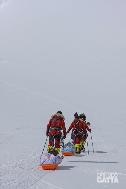
Good weather, we finally could fly to Vinson base camp. We took the 3rd of the 6 planes and took off at 17h. The flight was absolutely fantastic. The sky was clear except some clouds on the Vinson Massif itself. We landed at Vinson Base Camp (BC, 2100m) at 18h where we got a briefing from ALE staff. Then we sorted out the gear and food for the upper camp, loaded it on the sleds and buried everything else in a cache. At 21h we left BC in 2 rope teams of 3 and reached half camp 3h later in the clouds. By the time we pitched the tents, melted snow and ate it was 2am.
4.5km, +400m, 3h.
Dec 24: Vinson Half Camp (2500 m) - Low Camp (2750 m)
We were in the clouds when we woke up with a temperature -20ºC. Later on, it improved as we walked up the Branscom glacier and finally got warm. Taking our time, we reached Low camp at 19h30. Then we pitched our 3 tents and built snow walls to protect them from the wind. Taking advantage of 24h of sunlight, we went to sleep late.
4.5km, +250m, 4h30.
Dec 25: bad weather at Low Camp (2750m)
After a long hesitation due to the bad weather, we finally decided to stay at LC rather than doing the load carry to the high camp. Unfortunately we lost another day after the long wait at Punta Arenas and Patriot Hills.
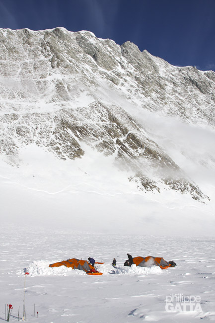
Dec 26: Vinson Low Camp (2750 m) - High Camp (3710 m)
In the morning, the weather was similar to the day before. After some discussions, we decided to change our plan and climb directly to High Camp in a single push, rather than carrying a load and doing a second climb the next day. Although this saved us a day, we had to carry everything in a single 25kg rucksack.
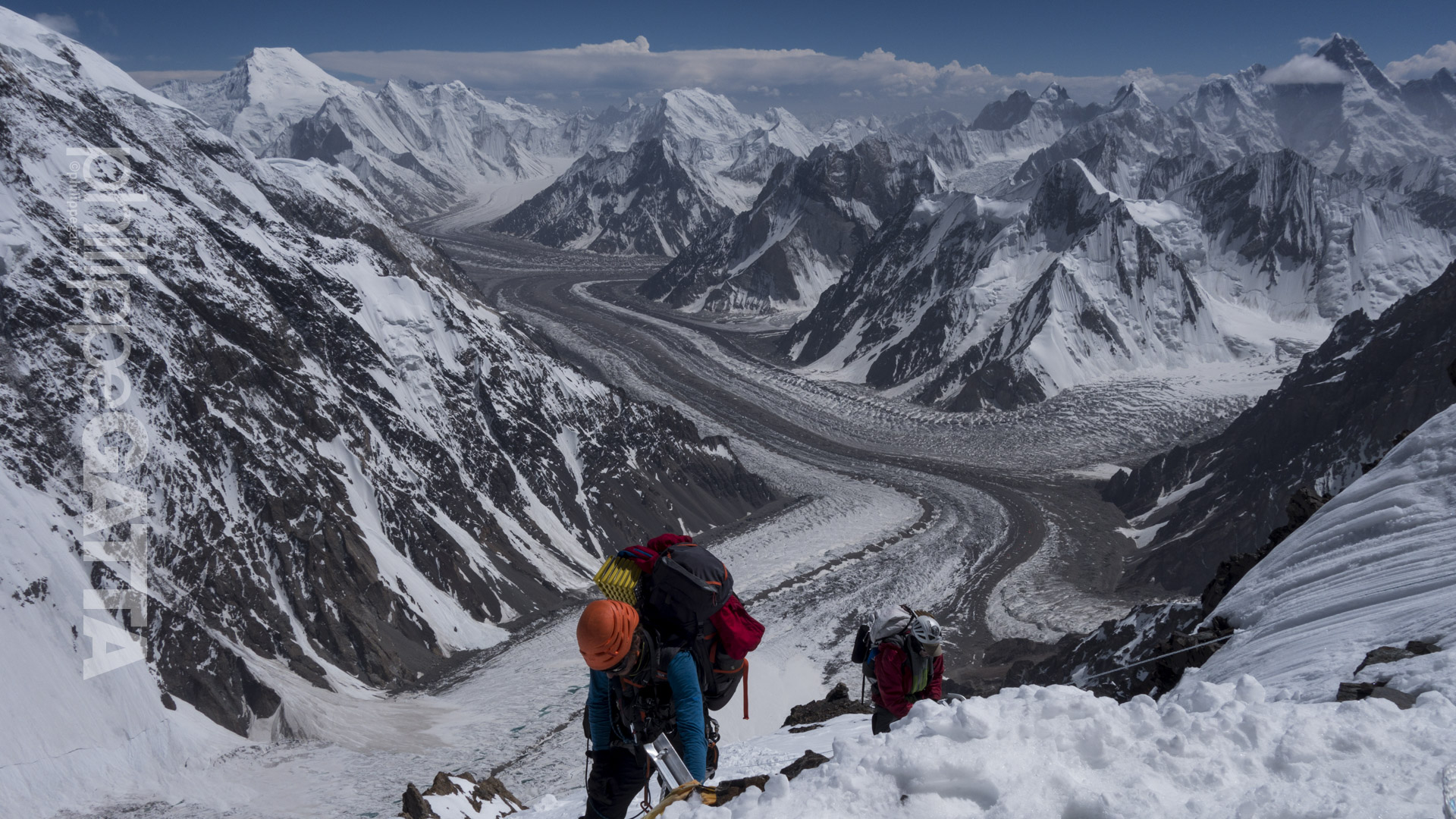
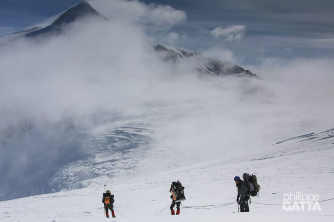
Like other teams, we decided to climb using the new route to avoid the crevasses and ice falls of the headwall. We spent several hours taking down tents and making a cache to leave gear, food, and one of the three tents. Leaving Low Camp at 15h, the temperature was -25ºC, and we were soon in the clouds. However, we quickly ascended above the sea of clouds at 3100m and enjoyed stunning views of Shinn, Gardner, Epperly, and Tyree glaciers.
The climb along the ridge took six hours, and we continued on the glacier towards High Camp. As we climbed, a cold wind began to blow. We arrived at High Camp at 23h30 and pitched the tent, built a wall, and cooked in harsh, windy, and cold conditions (-17ºC inside the tent). We finally got into our sleeping bags at 2h30 in the morning.
4km, +1000m, 8h30.
Dec 27: rest day at Vinson High Camp
Dec 28: High Camp (3710 m) - Mt Vinson Summit (4892 m) - High Camp (3710 m)
At 7am, we woke up and started preparing for the summit bid by boiling water, eating, and getting ready.
We left High Camp at 9h45 with great weather conditions: clear sky, light wind, and -25ºC. By noon, we had passed 4200m, and the wind picked up while the temperature dropped slightly. We put on our down pants, hand warmers, and big mittens.
Initially we had planned to take a gully instead of the normal route, but the snow and ice were harder than expected, and we didn’t have the proper gear, so we decided to turn back and take the normal route up Vinson. Unfortunately, we lost almost 2 hours and some energy, and the clouds started building up around us and Mount Shinn.
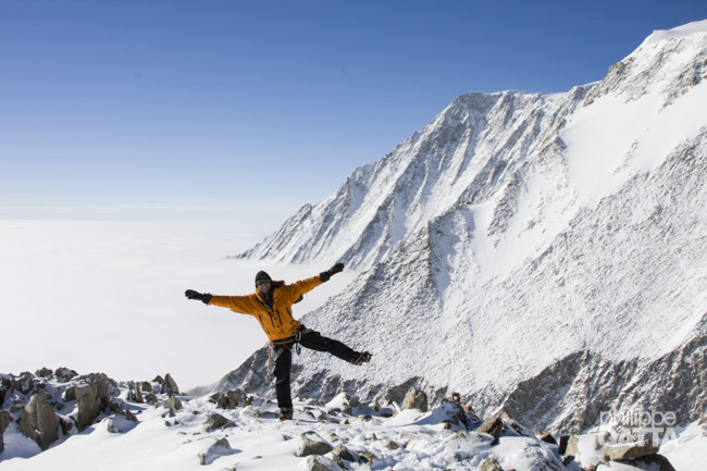
Eventually, we reached the summit of Vinson at 19h in poor visibility, but we managed to make it back to High Camp 2.5 hours later.
14km, +1230m / -1230m, 12h30.
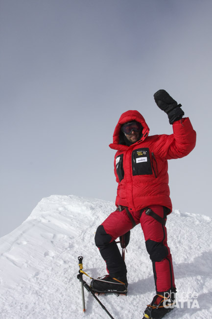
We finally reached the summit of Vinson at 7pm in poor visibility, clouds and a windchill of -45ºC.
Dec 29: High Camp (3710 m) - Mt Vinson Base Camp (2500 m)
In the morning, we were informed that the Twin Otters were expected to arrive at 18h from BC. At noon, we dismantled the tents, cleared the camp, and departed again carrying 25kg rucksacks. The weather conditions were better compared to the past three days and would have been ideal for a summit day.
Subsequently, we arrived at Low Camp by 14h10 and received an update about the flights. The conditions at Patriot Hills were so severe that no plane could fly out or in. As a result, we took our time to collect the remaining food and gear and placed everything on sleds. It was noteworthy that we were the last team on the mountain.
To proceed, we divided into two teams of three and roped up. The weather remained pleasant until half camp, where we entered the clouds. Eventually, we reached BC at 18h10. The weather at PH had not improved, and all flights were canceled that day. Just like other teams, we pitched our tents to spend one more night in the Vinson Massif. It was midnight before we finally slept.
Dec 30: Vinson Base Camp (2500 m) - Patriot Hills - Punta Arenas
The weather improved in the morning and could fly to Patriot Hills and then to Punta Arenas.
Environment
Expedition members followed the rules defined in the Antarctic Treaty of 1959. No trash and garbage have been left during the expedition, everything has been brought back to the base camp and then to Chili.