VIA ALPINA - TRAVERSE OF THE ALPS
1,000 KM AND +45,000 M, 7 COUNTRIES
Via Alpina - Traverse of the Alps
The Via Alpina is a network of five walking trails that span over eight European countries, covering a total of 5,000 km across the Alps. The trails offer stunning views and a wide variety of landscapes in a culturally rich environment.
Anna and Philippe sought a similar challenge to their traverse of Nepal along the Great Himalayan Trail (GHT). They wanted to explore seven European countries and sought a connection of trails that was less than 30 days, around 1,000 km in distance, and allowed them to discover some of the most beautiful parks of the Alps.
They decided to follow a combination of the red and green Trails of the Via Alpina, wishing to run across the Triglav, Dolomites, Tyrol, Bavaria, and Interlaken. To limit the overall distance to 1,000 km, they started in the Triglav National Park (Slovenia) and finished in Chamonix (France). They followed the Red Trail across Italy, Austria, Germany to Lichtenstein and then switched to the Green Trail to Lenk in Switzerland. From there, they made their own trail to Chamonix, France.
To travel light, they carried only the minimum required to be self-sufficient for 5-6 days, including clothes, a sleeping bag, an ultra-light tent, a stove, and food. They bought some food in the villages and huts and spent a few nights camping where they shipped some supplies in advance.
Via Alpina: Trigalv to Chamonix in 25 days
Day 1-5: Triglav (Slovenia) - Filmoorhütte (Austria): 190 km and +11,400 m
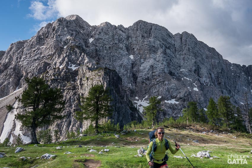
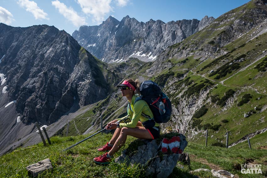
We started our traverse at Koca Na Gozdu mountain hut, below the Vrsic pass in the Triglav National Park (Slovenia). The rugged peaks of Triglav offers great scenery and we could have spent more time there. So it is worth starting the journey further South to completely cross the park.
After the Triglav, we went straight to Ratece and the famous three borders point, where Slovenia, Austria and Italy borders meet. From there, the descent and the crossing of Thörl-Maglern is not so nice until we reach Goriacher Alm. We slept in the tent the first night, glad to not see any bears. The trail continues along mountain pastures and forest up to the resort of Nassfeld. We slept a bit further in the Lomasti bivouac.
The following 3 days we remained on the ridge (border between Austria and Italy). The Trail is above the forest, offering 360 degrees view over the Alps.
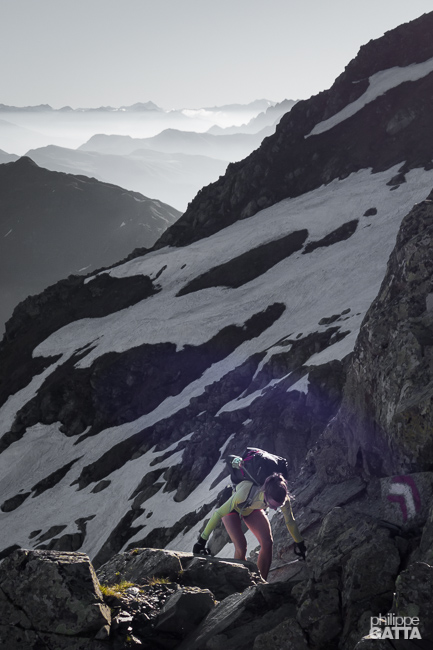
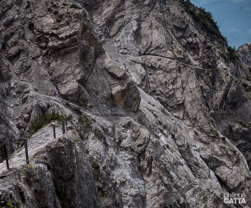
The trail is sometimes technical and can be challenging and even dangerous if there is some snow. Expect to be slower than usual and it’s worth taking plenty of water as there are not many springs along the way.
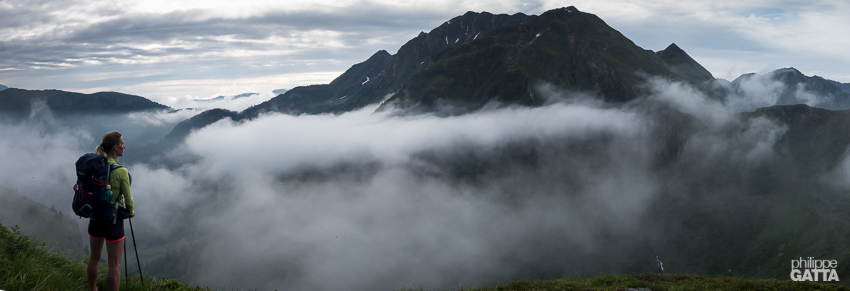
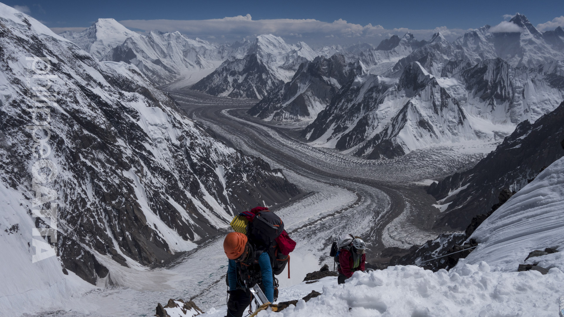
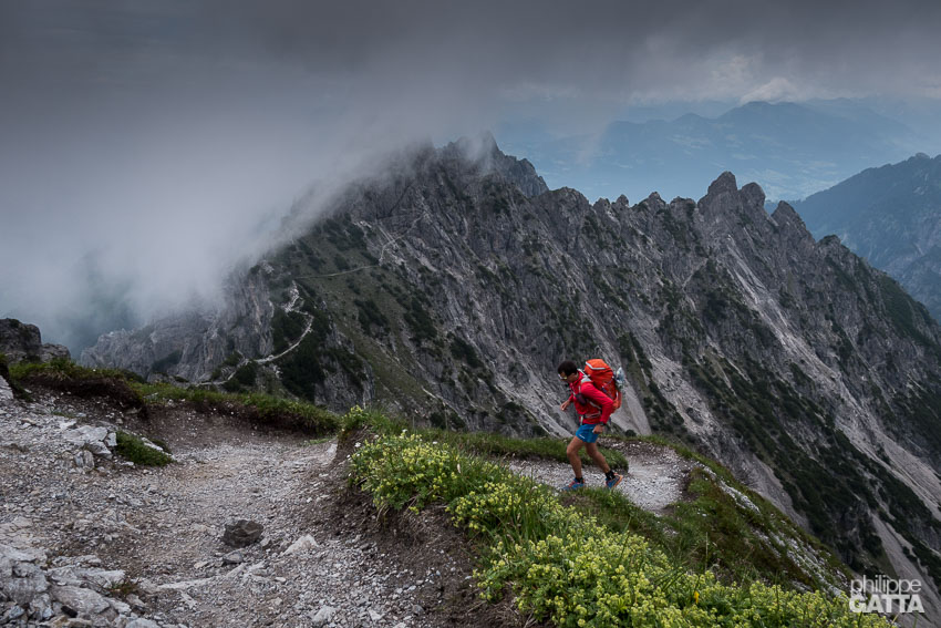
Between Nassfeld and Zollnersee Hütte, Austria (© P. Gatta)
Day 6-8: Filmoorhütte (Austria) - Lago di Neves (Italy): 110 km and +5,700 m
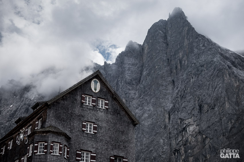
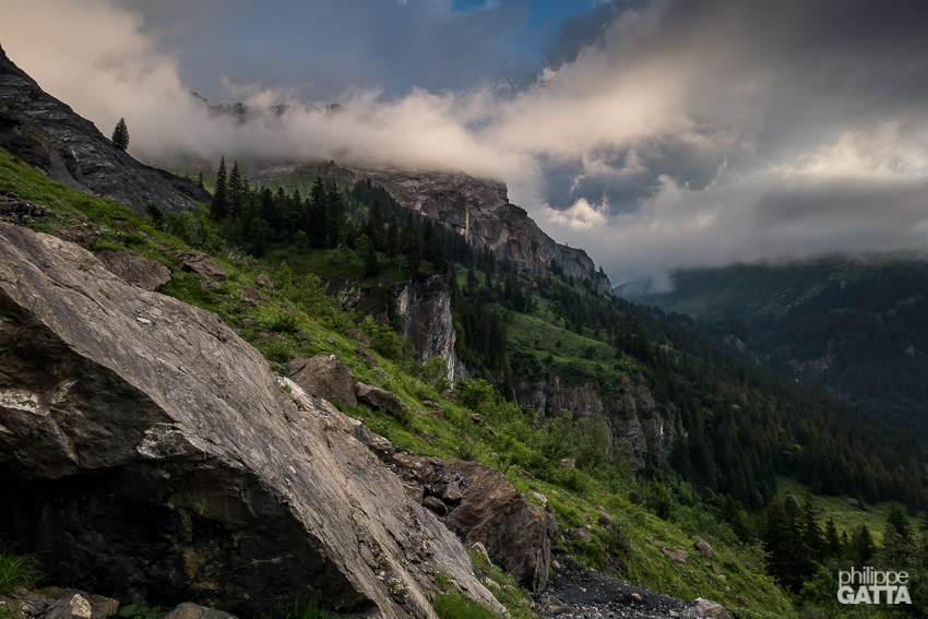
Once again the trail after Filmoorhütte is technical. Actually it is possible to skip Sillianer Hütte to take a trail more pleasant crossing the lovely mountain pastures and going straight to Moos. The village of Moos (a few kilometers South of Sexten) marked the end of 4 days spent on the border ridge mainly above 2,000 m.
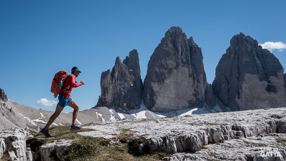
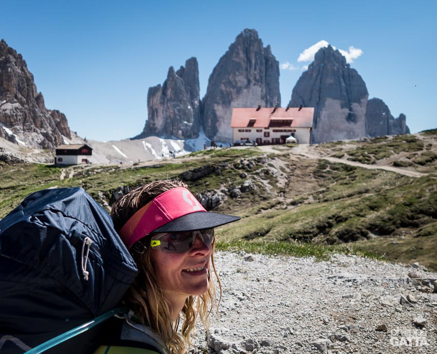
Entering in the Dolomites (and South Tyrol) was a big contrast: extremely hot, crowded but still absolutely beautiful. The long climb to Refugio Locatelli with the Tre Cime di Lavaredo in the background is amazing.
The descent on the West side on the rocky trail toward Höhlensteintal was hot and a bit long. We bivouacked in a forest and continued our traverse of the Dolomites the following day which is one the nicest place of the Via Alpina.
There is no interest to run along the road between Lago Di Braies and Anterselva di Mezzo. There is a nice Camping at Antholz. After Antholz there is 1,530 meters non-stop climb to Rieserfernerhütte, followed by a long descent to Sand in Taufer (town).
We had a storm after Sand in Taufer so we avoided the exposed ridge of the Via Alpina and followed a lower valley (South) through Mühlwald. We continued in really bad weather up to the Lago di Neves where we found shelter in a barn (thanks to the owner). Note that despite what is written on certain maps, there are no huts by the lake.
Lower trail between Filmoorhütte and Moos, Austria. The Dolomites in the background (© A. Gatta)
Day 9-14: Lago di Neves (Italy) - Biberwier (Austria): 200 km and +9,000 m
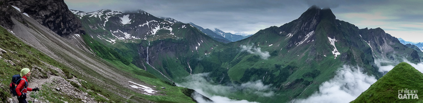
After a night spent in a barn sleeping above the cows, we started our trail toward Pfitscherjoch Haus under a cloudy sky. The weather became worse and we crossed the Gliderscharte pass (2,644m) in a storm with less than 50m visibility (thanks to the GPS). We finally reached the Passo di Vizze hut completely wet. The following day the weather slightly improved and we could enjoy the scenery of the valley going to Mayrhofen (back in Austria), completing the traverse of the Zillertal Alps.
After Rastkogelhütte we reached the city of Schwaz, Tyrol, Austria where we enjoyed hot shower and good food. We left Schwaz and we crossed the Karwendel mountain range, a Natural Park and one of our preferred place of the Via Alpina.
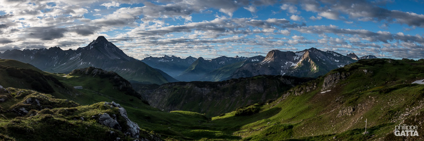
The beauty of Karwendel
The Karwendel is located North of Innsbruck. It is a relatively small mountain range with peaceful alpine pasture, meadow and steep vertical limestone walls.
We spent the night in the Falkenhütte (bivouacking is forbidden in the park) and continued our trail in the Karwerndel the next day.
Then we completed our traverse of the Karwendel under a heavy thunderstorm, finding shelter in a café of Scharnitz before continuing our day to the camping of Reindlau. Later, we left Reindlau early in the morning, crossing hundreds of Salamandras along the way. After a 1,420 m non-stop climb in Wetterstein mountains, we passed the Meilerhütte, a quite unfriendly hut. The hut is located on pass which marks the border with Germany.
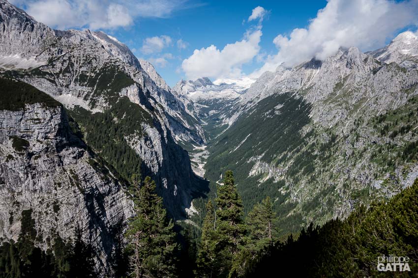
The 5 km with 1,500 meters drop to the Reintal valley is tough for the knees but like the Karwendel, it is another wonder of the Via Alpina. This beautiful valley, located less than 10 km South of Garmisch Partenkirchen, progressively rises up toward the West, up to the top of the Zugspitze, the highest mountain in Germany. You can expect a lot of people but it is a place not to be missed.
Before the top of the Zugspitze, the Via Alpina turns South to the Gatterl pass and returns in Austria. We ultimately reached the camping in Biberwier after 40km and +2,640m.
Amazing scenery of the Karwendel mountain range, Austria (© P. Gatta)
Day 15-18: Biberwier (Austria) - Gaflei (Liechtenstein) - Untersass (Switzerland): 140 km and +6,500 m
We took a bus from Biberwier to Weißenbach am Lech as we didn’t find this part so interesting. We resumed our trail at Weißenbach am Lech but the following 18 km were not so nice neither (road and dirt track) and could have been skipped too. Once again the rain came and we reached Prinz Luitpoldhaus in pouring rain.
The descent from Prinz Luitpoldhaus to Oberstdorf was nice with plenty of waterfalls and a dramatic atmosphere. From Oberstdorf it is better to take a bus to Birgsau as walking along the road has no interest. After Birgsau (Germany) up to Hotchtannberg (Austria) the Via Alpina is very scenic and pleasant again.
The Trail continues across mountain pastures all the way to Buchboden. There is a nice camping further down, just before Raggal. Between Buchboden and Feldkirch the Via Alpina follows the road for 35 km so it’s highly recommended to hitchhike or take a bus.
Liechtenstein
After Feldkirch we left Austria to enter in Liechtenstein. The climb from Feldkirch to Gafleispitz is long, +1,900m for 13km.
The trail below Alpspitz is very technical, sometimes dangerous and exposed (especially during thunderstorm).
We left the Red Trail of the Via Alpina (stage R57) at Gaflei and switched to the Green Trail (C1). The section from Gaflei (Liechtenstein) to Schwendi im Weisstannental (Switzerland) is mainly along big road, train and cities. Fortunately, there are plenty of buses to escape and get back to the mountains. We bivouacked in a nice place not far from Untersass.
Day 19-25: Untersass (Switzerland) - Chamonix (France): 280 km and +12,700 m
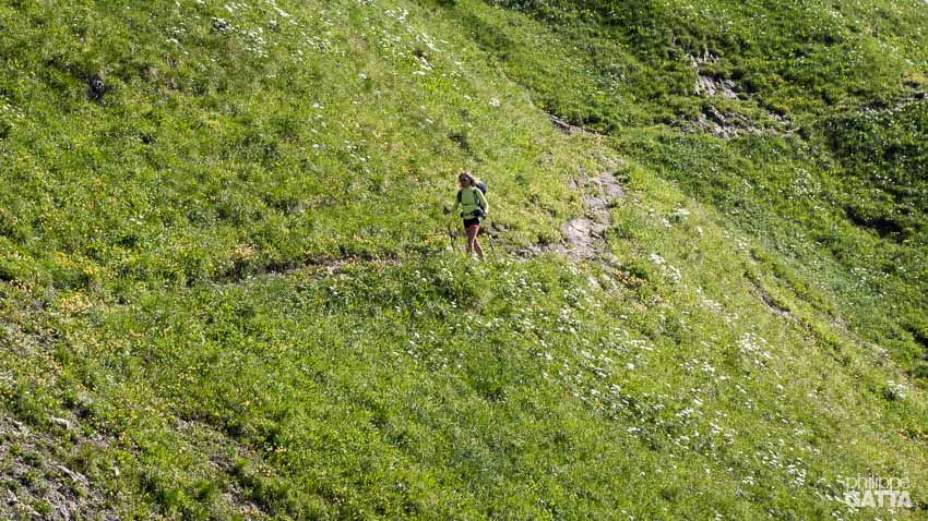
We left Untersass early in the morning in a typical Swiss pasture landscape: perfect green grass, colorful flowers, happy cows, waterfall and perfectly well marked trail.
The Trail crosses several nice passes and villages, the only “so-so” section is around Linthal. If Linthal is not so nice, the valley of Urnerboden, just after, is beautiful. Perfect meadow surrounded by step limestone cliffs, waterfalls and dominated by Clariden, a 3,267 m peak.
The valley ends by the Klausenpass and the trail continues along the road for 22+ km to Altdorf and Attinghausen. After a nice bivouac close to the Surenenpass, we continued the trail to Engelberg.
After Engel, the Trail goes up straight under the ski lift which is not so exciting. Fortunately, the scenery is amazing again, especially after the Jochpass.
We passed the Tannensee lake and continued on a scenic trail to Meiringen.
Meiringen – Grindelwald – Lauterbrunnen is another highlight of this traverse with breathtaking views over the Eiger, Jungfrau, Mönch… on the flip side, it’s crowded, noisy and horribly expensive. We were finally happy to escape the crowd and discover the lovely village of Mürren.
The section from Mürren to Adelboden is really nice and is a perfect representation of the Swiss Alps: green pasture, snowy peaks, pretty, clean and quiet villages. The Via Alpina is perfectly marked and it is easy to find the trail.
Adelboden - Chamonix
We spent a fortune in a bakery at Adelboden, trying to get some energy to reach Lenk, the end of the Green Via Alpina Trail. The climb to the Hahnenmoospass from Adelboden has no interest; the trail follows the road and goes under the ski lifts. We were one of the few going up, crossing scootering descending full speed on the road… The descent from Hahnenmoospass to Lenk is not exciting either, especially under the rain, fortunately there was a bus…
After Lenk we planned to make our own connection of Trail to join Chamonix. Unfortunately the weather changed for the worse and it snowed above 2,000m, so we had to change our plans. Finally we decided to go South, cross the Rawilpass to join Sion – Matigny. Then we crossed the pass in the storm with less than 50 meters visibility (thanks to the GPS again). We reached Sion soaking wet.
We continued our journey in poor weather and finally reached Chamonix after 25 days, exhausted but happy. Crossing a mountain range is always a great experience with plenty of up’s and down’s. This one is no exception. If we were do it again, we would completely skip some sections and spend more time in the nicest places.
Between Nassfeld and Zollnersee Hütte, Austria (© P. Gatta)