Fun weekend with Anna in Italy; we climbed Breithorn the fist day and ran around Valtournenche and Cervinia the second day. A good combo of 40km and +2200m in a very scenic place.
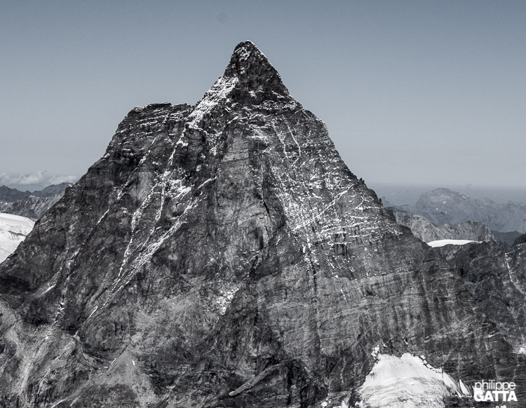
Matterhorn seen from the Breithorn (© A. Gatta)
On the first day: Breithorn
We started from Testa Grigia and followed the normal route to the Eastern and central summits of Breithorn, 4164m.
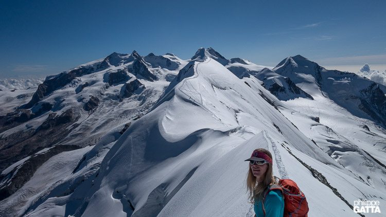
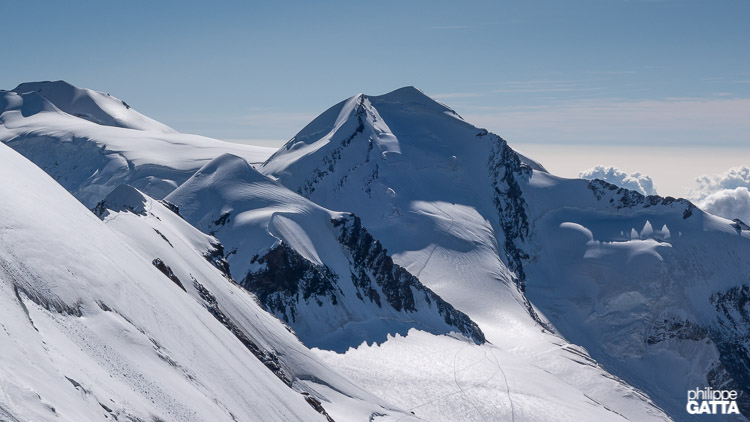
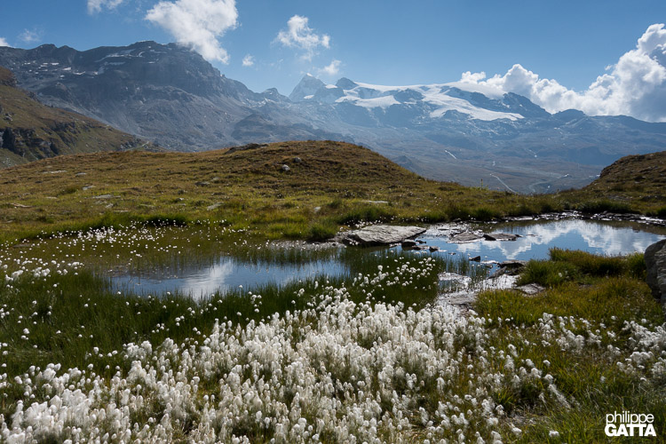
View from the top of the Eastern summit of Breithorn, the Central summit behind and further Castor, Pollux, the Liskam and the Monte Rosa (© P. Gatta)
The round trip from Testa Grigia to the Breithorn is about 11km, +800m/-800m.
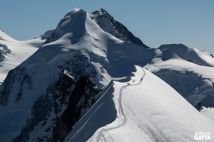
Climbers on the Central summit of Breithorn, the Liskam in the background (© P. Gatta)
Polux and Castor seen from the Breithorn. The Liskam further left (© P. Gatta)
Second day: we ran along the trail Number 65
Fun weekend with Anna in Italy; we climbed Breithorn the fist day and ran around Valtournenche and Cervinia the second day. A good combo of 40km and +2200m in a very scenic place.
Matterhorn seen from the Breithorn (© A. Gatta)
On the first day: we started from Testa Grigia and followed the normal route to the Eastern and central summits of Breithorn, 4164m.
View from the top of the Eastern summit of Breithorn, the Central summit behind and further Castor, Pollux, the Liskam and the Monte Rosa (© P. Gatta)
The round trip from Testa Grigia to the Breithorn is about 11km, +800m/-800m.
Climbers on the Central summit of Breithorn, the Liskam in the background (© P. Gatta)
Polux and Castor seen from the Breithorn. The Liskam further left (© P. Gatta)
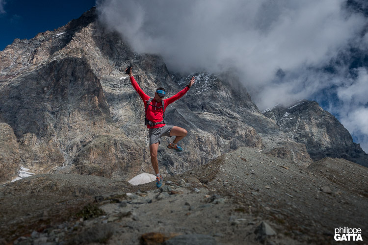
Second day: trail running around Cervinia
We ran along the trail Number 65. We started our trail at Perrerès, between Valtournanche and Cervinia. Then we went up toward Grillon, turned right to Montagne des Bayettes. After, we continued to the Refugio Duca degli Abruzzi. Then the trail goes to Plan Maison, Lago Golillet, Bec del Plo Merlot, Manda Desot and then back to Perreres.
Tza Grillon, above Perrerès, the Matterhorn in the background (© P. Gatta)
The full loop is around 28km, +1400m/-1400m.
Tza Grillon, above Perrerès (© P. Gatta)
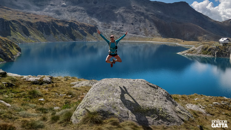
Lago Goillet (© P. Gatta)
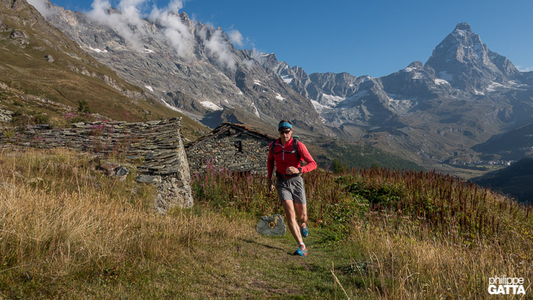
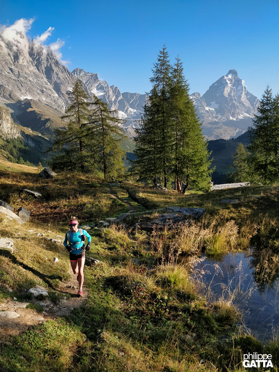
On the way to Alp Bayette, the Matterhorn in the background (© A. Gatta)
Overall the trail is excellent and very well marked.
On the way to Alp Bayette, the Matterhorn in the background (© A. Gatta)
Alps Cors above Cervinia, the Breithorn in the background (© A. Gatta)
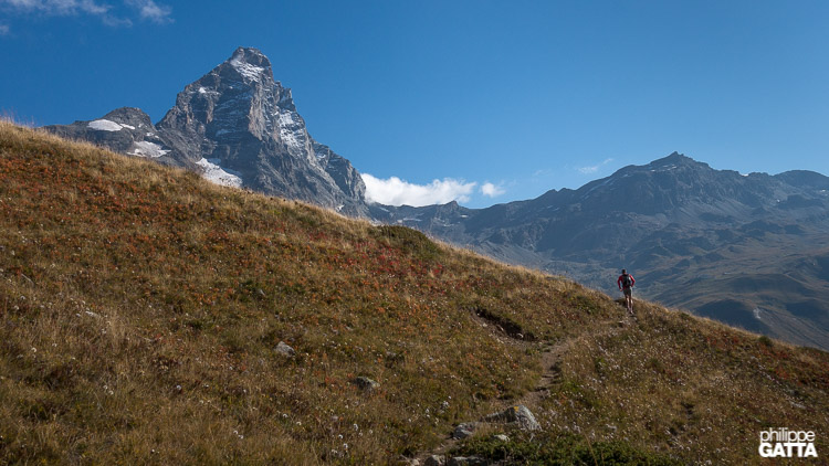
Close to Oriondè hut, the Matterhorn in the background (© A. Gatta)
. We started our trail at Perrerès, between Valtournanche and Cervinia. Then we went up toward Grillon, turned right to Montagne des Bayettes. After, we continued to the Refugio Duca degli Abruzzi. Then the trail goes to Plan Maison, Lago Golillet
down to Avouiland .
Tza Grillon, above Perrerès, the Matterhorn in the background (© P. Gatta)
The full loop is around 28km, +1400m/-1400m.
Tza Grillon, above Perrerès (© P. Gatta)
Lago Goillet (© P. Gatta)
On the way to Alp Bayette, the Matterhorn in the background (© A. Gatta)
Overall the trail is excellent and very well marked.
On the way to Alp Bayette, the Matterhorn in the background (© A. Gatta)
Alps Cors above Cervinia, the Breithorn in the background (© A. Gatta)
Close to Oriondè hut, the Matterhorn in the background (© A. Gatta)