
If you are looking for a technical Trail with lots of ascents and descents, there are mainy choices within one hour drive from Nice. Sunday I made one that is a perfect training and test for an Ultra endurance race. It crossed 3 valleys: Vésubie, Tinée and Paillon, 5 passes (Cols) for a total of 55 km and 4300 m of ascent. There are 4 main climbs of +1000m each, with 4 technical descents in between where it is hard to run fast. So overall this trail is rather tough.
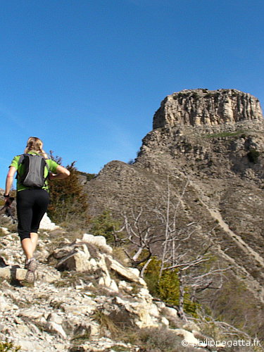
Running toward the Castel de Gineste (© P. Gatta)
Trail distance: 55 km, ascent: 4300m / descent: 4300m.
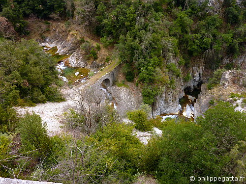
Small bridge above Planfaé (© P. Gatta)
Trail description: park at St Jean la Rivière, climb to Utelle (signpost 131, 124, 12, 11, 10). Continue along the GR 5 toward Col de Castel de Gineste (111, 112, 113, 156). At the signpost 138 turn left on the Crète de l’Albabéra down to the Pas Masséna (there are chains to ease the descent at the end). All this section is steep, technical and the trail is not always well marked but it remains along the crest (really nice view). Go down to a small bridge (13, 11) and then go up to la Tour sur Tinnée (5). Follow the Gr 510 to the Col de Grateloup (15, 16, 153). Continue to follow the GR 510 down to le Suquet (154, 157, 158, 16a, 19, 18, 127). This is a bit more than the half trail (28km, +2200m).
Continue along the GR 510 toward the Col de la Porte (128, 194) in a nice forest. At the signpost 194 go down toward the Southwest toward Ruisseau de Planfaé (river), the trail is not easy to find at the beginning. It is the same trail followed by the Transvesubienne mountain bike race, it passes through a point marked 1001m on the IGN map (Mairanesca), crosses Planfaé river at 792m and goes up tot the signpost 195. Then continue on a much better trail toward Baisse de la Graou (196) and la Pare (197, 239). Cross the small bridge above Planfaé and gos up to the small village of l’Engarvin (240, 465, 464, 463). Continue to climb to the Col de St Michel (463, 443). Pass the nice ruins of Roca Sparviera (444) and go to the Col de l’Autaret (447, 448). Go down to l’Imberguet (123, 122) and continue to St Jean la Rivière (121, 131).
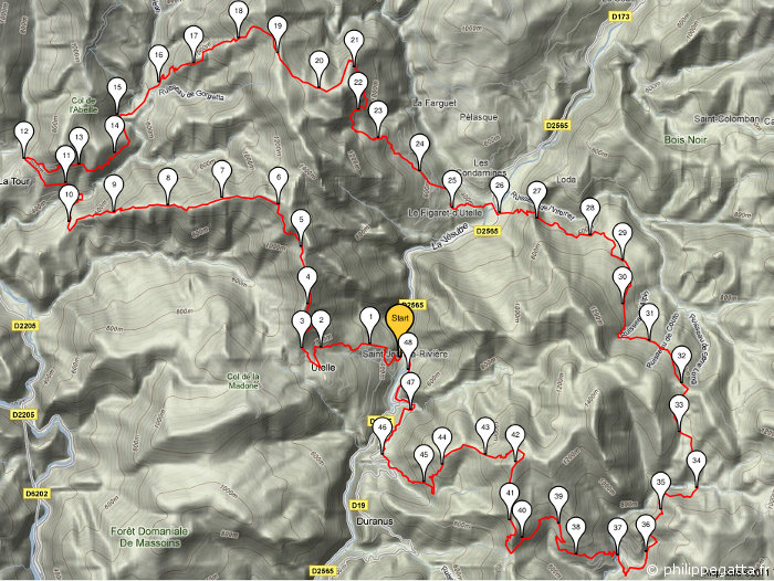
Map of the trail (© P. Gatta)
Trail options: there are many options to make this trail shorter. One obvious one is to cut after the village of Figaret and go back straight to St Jean through the signposts 16, 15, 14, 13 and 131. The second option is skip the descent to Planfaé: after the signpost 194, go straight to col de l’Autaret through Plat Liberte (449, 448).
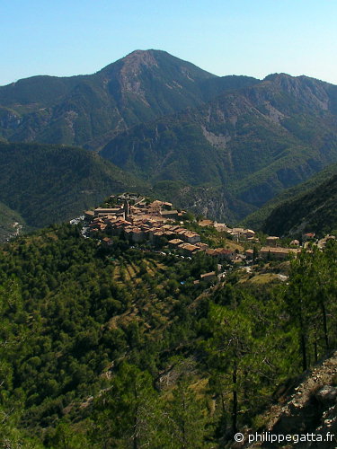
Village of Utelle (© P. Gatta)