
For this second trail since I came back from the Kangchenjunga, I wanted to check how I felt on a “long” trail. So I went around Plan du Var and Mont Ferion where there are plenty of choices to make nice and steep trails. The one described here is quite nice as it follows the crests above Coaraze and offers great views over the Alps and the Riviera.
Distance: 45 km, ascent: 2950 m / descent: 2950 m.
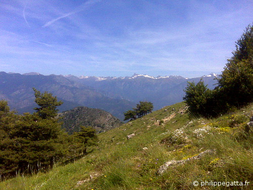
View over the Alps from the Cime de Roccassiera (© P. Gatta)
Description: park at Plan du Var (150 m). Climb to Levens (signpost 298, 296, 294, 293, 292). Continue up to the Mont Férion via the Col of Dragon (250, 251, 252, 253, 254, 255, 256, 257, 272, 273). Go down to the village of Coaraze (206, 205, 204, 203, 201, 200). Continue the descent to Plan de la Linea (424 m. 220, 221, 222). Go left and take the trail going to La Serre (242) then climb the steep trail to the Baisse de Buse (719 m. 226). Follow the trail to the Baisse de Marsan (227)), Col du savel (237), Col St Roch (232, 235). Follow the GR 510 to the Col de la Porte (1057 m. 187, 188, 189). Traverse the Cime de Roccassiera (1501 m. 194, 449). Descend to Col de l’Autaret (448) and continue to Col St Michel (447, 444, 443). Follow the trail l’Affaia (460, 459, 458, 457). Climb to the Col de Fuont Blanca (1079 m. 257). Go back down to Plan du Var through the same trail than the way up.
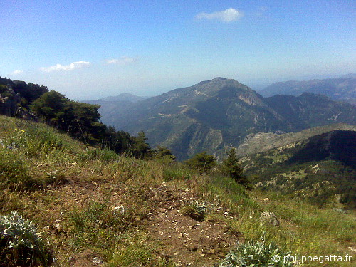
Mont Ferion seen from the Cime de Roccassiera (© P. Gatta)