KANGCHENJUNGA (8,586 M), SOUTHWEST FACE
HIMALAYA, NEPAL
The Kangchenjunga is a mountain of the Himalaya range, at the far East of Nepal on the border of the district of Sikkim and around twenty kilometers South of Tibet. It is one of the 14 mountains on Earth that are more than 8,000 meters (26,247 ft) high above sea level. With an elevation of 8,586 m, Kangchenjunga is the third highest, after Mount Everest (8,850 m) and K2 (8,611 m).
The Kangchenjunga is also called Kanchenjunga, Kangchen Dzo-nga or Kachendzonga, which means The Five Treasures of Snows.
Kangchenjunga contains five peaks, four of them are above 8,400 meters: main summit (8,586 m), West summit (8,505 m), central summit (8,482 m), South summit (8,494 M) and Kangbachen (7,903 m).
The Kangchenjunga is the second least climbed peak of the 14 peaks over 8,000 meters. In fact the Annapurna is the only 8,000 meters peak which has been less climbed than the Kangchenjunga.
Since the first ascent in 1955, only 243 climbers have reached the top of Kangchenjunga, while during the same time 4,500 persons reached the top of Everest (including 91 French). Before our expedition there were only 3 French among the 243 climbers; Michel Parmentier and Jean-Jacques Ricouard in 1981, and Pierre Beghin in 1983. In 1995 Benoit Chamoux and Pierre Alain Royer disappeared in the North face. At that time Benoit was about to complete the challenge of the 14 x 8000ers. It finally took 28 years to see two other Frenchmen, Philippe Gatta and Ludovic Challéat, reach the top of Kangchenjunga.
The Swiss had more successes with 9 climbers, including Erhard Loretan for which the Kangchenjunga was the last in the list of 14 (in 1995 too). After our successful expedition, Cédric Hahlen became the 10th Swiss climber to reach the top.
Sources: 8000ers.com and Himalayan Database from Elizabeth Hawley archives (himalayandatabase.com).
Our Kangchenjunga Expedition
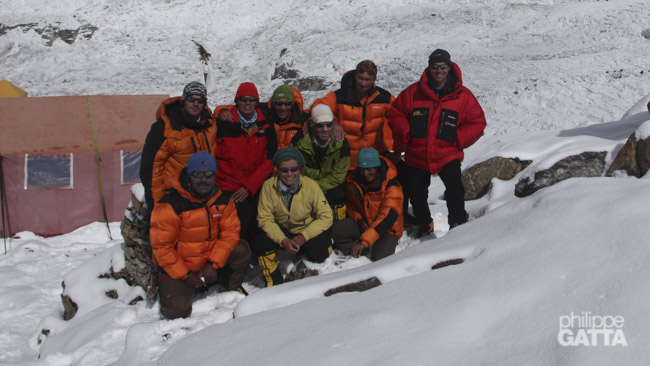
The French-Swiss team is made of Ludovic Challeat, Alexia Zuberer, Régine Tornay, Benoit Rosset, Jean-Marc Wojcik, Cédric Hahlen, Gorgan Wildberger, Pemba Sherpa and Philippe Gatta. Anna Gatta has joined the Team up to the base camp of Kangchenjunga and came back through the North circuit and the three passes: Sinelapche La (4,650 m), Mirgin La (4,585 m) and Selele La (4,210 m).
The Route
The Team climbed the route opened by Joe Brown, George Band, Norman Hardie and Tony Streather in May 1955. This route is located in the Southwest face of Kangchenjunga, also called the Yalung face. Only 162 climbers have succeeded this route since 1955.
The route starts at 5,500 meters on the Yalung glacier where the base camp (BC) is established.
Above the BC, the route follows a rocky spur up to 6,000 m. Then it climbs steep slopes and the serac up to a snow ridge at 6,200 m where the camp 1 stands.
From the camp 1, the route follows a short horizontal ridge, then descends on a plateau and cross this plateau. The camp 2 is located at the end of the plateau and the bottom of the face, at around 6,400 m.
From the camp 2, climb the snow slope above. It may be hard to find a way between the numerous seracs and crevasses, especially in bad weather. The camp 3 can bet set at the top of the slope or even better on the plateau itself at around 7,200 m.
From the camp 3, continue on the plateau where there are crevasses and seracs. Continue to the base of a spur, at the base of the big Couloir. The camp 4 can be set between 7,500 m and 7,700 m.
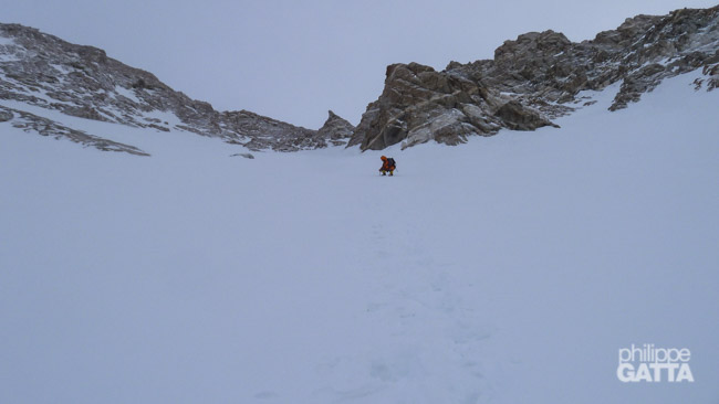
From the camp 4, climb the Couloir up to 8,250 m. The Couloir splits in two, take the right side and traverse right (Diagonal) to the base of a steep wall (around 8,380 m). Climb the wall which is graded III+, continue to a rocky tower at around 8,450 m (also called the “Bivouac”). Climb a short snowy ridge then traverse to the right to a Chimney at around 8,500 m. Rappel down the Chimney, traverse to the right on mixed terrain to join a snow slope leading to the main summit at 8,586 m.
Trekking to the base camp of Kangchenjunga
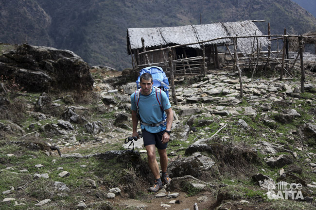
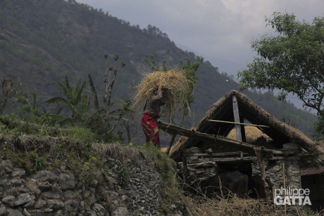
The region of Kangchenjunga is very wild; there are almost no trekkers and no lodges. Overall the trekking is much harder than the ones of the Annapurnas or the Everest. There are no support for trekkers, it’s very hard to find porters and there are important elevation changes (from 700 m to 5,500 m).
April 9: Katmandu - Tharpu (1,300 m)
We fly from Katmandu to Bhadrapur in the morning. As soon as we arrive, we pick-up our gears arrived yesterday by truck and we jump on 4-wheel toward Tharpu. We quickly gain altitude, we pass Ilam, the Nepalese Tea capital and continue up to 2,500 m before going down and up again. We leave the road for a muddy dirt road. The rain is pouring down and there are lightnings every 5 minutes. We eventually make it to Tharpu late in the evening after 8h30 drive.
April 10: stuck at Tharpu (1,300 m)
Unfortunately the 40 porters who were supposed to carry our gear up to the base camp are not there. Some of them were coming from Taplejung but the road is closed due to a major land slide. A few others actually arrived, but ended up at the hospital or in jail after a knife fight. So we spend a day here, hoping that some porters will arrive later in the day.
April 11: Tharpu (1,300 m) - Doban (1,020 m)
Some porters have arrived but not enough to carry everything. So we decide to leave with the minimum kit necessary for the trekking. Pemba stays at Tharpu and try to hire more porters to carry the rest of the gear.
We finally leave Tharpu at 9am, it’s not too warm and the sky is clear. First we descend to the river at 720 m which is the lowest point of the trekking. Then we traverse the valley toward the North. We stop at Doban which is a tiny village made of only 3 houses. This stage has been quite long for the porters, some of them arrive at 21h. As in Tharpu we sleep on rudimentary wooden “bed”. The roof is far from waterproof and during the night the rain goes through.
Stage: 18 km. Elevation: +670m / -905m. 4h45.
April 12: Doban (1,020 m) - Yamphudin (2,070 m)
On the morning, the porters refuse to walk the complete stage to Yamphudin. That means we have to carry all our kit ourselves to be autonomous. Then we rearrange the loads and give the fastest porters the food to make sure to have enough to eat at each stage.
The climb above Doban is steep but nice and so is the traverse up to Khebang. This village is really nice, clean, spread out with nice garden and various cultures. The steep climb continues up to the Ekchana La pass at 2,080m. We make a short break before descending to Otam. Then we climb again to the second pass of the day. Follow another descent down to the river and the last climb up to Yamphudin. There are many prier flags at the entrance of Yamphudin which is the larger village in the valley. Here too, there are no lodge so we sleep in some people’s house who are much more friendly than in Doban.
Stage: 15 km. Elevation: +1870m / -830m. 6h.
April 13: Yamphudin (2,080 m) - Tortong (2,990 m)
We leave Yamphudin under a clear sky but not for long. The trail is flatish at the beginning and soon becomes quite steep in the long climb to the the Sanyia Bandyiang (3,330 m) pass. This climb is in the rain forest, the Rhododendrons and the Magnolias is amazing. When we reach the pass, the sky is dark and the thunderstorm gives to this place a special atmosphere. A massive land slide on the North face of the col forces us to climb 200 m more along the crest. Then we descend on a muddy trail down to the river that we follow for a while until we reach Tortong.
There are only two small houses and one shelter in Tortong. We spend the afternoon in one of them, close to a fireplace to try to get warmer. It’s raining, cold and humid. We spend the night laid down on the floor in one of the rooms.
Stage: 11 km. Elevation: +1705m / -830m. 5h30.
April 14: Tortong (2,990 m) - Tseram (3,870 m)
The trail goes up gently along the river in another nice forest. Here again the Rhododendrons are blooming. This stage is shorter and easier than the previous ones but again the sky covers up and it’s snowing when we arrive at Tseram. There are only two houses there and a few tents. We stay in the first one which is quite uncomfortable. There are holes in the walls and the roof so the wind and the snow go through.
Stage: 9 km. Elevation: +880m / -30m. 3h10.
April 15: walk around Tseram (3,870 m)
Today we stay at Tseram to start our acclimatization. After the breakfast we walk toward the Sinelapche La (pass). We walk up to 4,580 m, enjoying the view over the Kabrus, Ratong and the valley going to the Sikkim (India).
Walk: +715m / -715m. 2h30.
April 16: Tseram (3,870 m) - Ramche (4,450 m)
We leave Tseram in a nice weather, I think that’s the first day without a single cloud. Once again the trail is really nice, there are less trees and the mountains around are getting higher and higher. This stage is short and it’s still early when we arrive in Ramche. There is only one house there surrounded by mountains and the Yalung glacier. It’s a peaceful and pleasant place.
We walk around and go to the moraine to take some photos and for once the weather remains nice all day. We spend our first night in a tent, it’s a pleasure after so many nights spent on the floor of cold, humid and dirty houses. In the evening, Dawa and the porters who were late in Yamphudin arrive. We have part of our gear but we still don’t have any news from Pemba and the 25 other porters.
Stage: 6 km. Elevation: +570m / -10m. 2h40
April 17 and 18: walk and rest at Ramche (4,450 m)
Another great day. We leave in small groups for some acclimatization walks. Anna and I walk toward Oktang where we can see the Kangchenjunga for the first time. After an hour or so I start to feel very tired and coming back to the camp is a pain. In the afternoon, it becomes clear that I’m ill with high fever, muscles pain and I’m freezing cold. I sleep 16 hours non-stop.
The following morning I feel a bit better but I’m still very tired. Alexia and Cédric feel the same and we all spend the day resting. The low altitude porters leave and some Sherpas carry our gear between Ramche and the base camp (BC). There are only 9 so they will have to make several round trips to bring everything to the BC. They will carry the kitchen and the part of the food first while we will carry our own stuff. We need 4 days of food so we can wait for their next load carry.
Walk: +355m / -355m. 2h.
April 19: Ramche (4,450 m) - Oktang (4,850 m)
I spent a very bad night; diarrhea, fever, being nauseous… In the morning, I feel really bad with an oxygen saturation only at 81% and a heart rate at 100 bpm. I do not want to stay behind the team so I decide to continue anyway but I fear this long day. Cedric who has some fever too, decide to stay in Ramche two more days with Regine.
As I expected, the climb in my state is a pain and I’m extremely slow. The first part up to the Shorten is very nice but after 2 hours we leave the good trail and start the walk on the nasty moraine of the Yalung glacier. In fact there is no trail, just endless pile of stones. It’s painful, long and exhausting.
Then the weather becomes bad, we missed the right “trail” several times and end up exposed under rock falls and crevasses. For me this day turns into a nightmare. Anna patiently stays with me. We are far behind the others except from Jean-Marc who just a bit ahead of us. In fact we do not stop in Oktang but 2 km further on the glacier at around 4,850 m. When we finally arrive, it’s snowing and we quickly put up the tents. In the evening we squeeze ourselves in the kitchen tent to get some warmth.
Stage: 7 km. Elevation: +505m / -190m. 4h30.
April 20: Oktang (4,850 m) - Kangchenjunga Base camp (5,475 m)
It snowed all night and in the morning the moraine is covered by several cm of snow. I feel a bit better but I’m still weak. The painful moment of the separation has come; Anna returns to France… I’m the last one of the group a bit behind Jean-Marc. After only 10 minutes of walk I fall and break one of my poles. This walk on the moraine is endless.
After 3h30 we reach a frozen lake at the bottom of the last big slope. I eventually reach the base camp, it took me 5 hours to make just 5.5 km. The base camp area is quite large, with amazing view but is not flat and full of big rocks. It’s not easy to find a good spot so we dig and move the stones around to make some good spots. We are all set but the tents are quite spread out. At the end of the day, we quickly eat and go to bed, dead tired from the walk and the elevation of 5,475 m.
Stage: 6 km. Elevation: +785m / -200m. 5h30.
Story of the 32 days of ascent
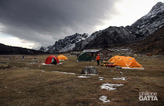
April 21 and 22: Kangchenjunga base camp (5,475 m)
We spend these two days to improve our camp, prepare the gear and the food for the high camps and to rest. We try to not do too much effort as we progressively acclimatize to the 5,475 meters of altitude. The climbers from the other expeditions who arrived earlier are going back and forth between the base camp and the camp 1 (6,200 m). Some porters arrive with part of our gear but the majority is still missing and we still don’t have any news from Pemba.
Walk: +-140m. 1h.
April 23: base camp (5,475 m) - Camp 1 (6,200 m) - base camp
The plan for today is to make a round trip to the camp 1 to carry some gear. We are not acclimatized enough to spend a night so high yet so we go back down to the BC.
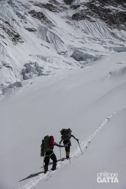
To reach the C1 we cross the entire base camp and 10 minutes later we are on the glacier. Twenty minutes later we reach the bottom of the face at 5,600 m. We continue along a spur (to its right) up to 6,000 m. Then we traverse to the left to join the steep slopes and the seracs just below the camp 1. The last 3 pitches are the steepest with some sections at 60-70 degrees. The camp 1 is located on a snowy ridge at 6,200 m. The view is amazing: Jannu, Kabru and the entire Yalung glacier.
April 24: Kangchenjunga base camp (5,475 m)
Everyday the weather is nice in the morning but it snows in the afternoon. Today we rest at the base camp and prepare to leave tomorrow for our first acclimatization trip. The plan is to spend 4 nights at 6,400 m and 2 or 3 nights at 7,000 m. Then we will come back at the base camp, rest and wait for several days of good weather to do the summit push.
April 25: BC (5,475 m) - C1 (6,200 m)
It snowed 15 centimeters during the night and the sky it covered, but it is not too bad so we decide to go anyway. It’s snowing a bit as we climb but at least we won’t burn in the sun. The Sherpas leave the loads and go back down to the BC while we sleep in C1 as planned.
Climb: +700m. 3h30.
Heart Rate (climb): average: 145, min: 116, max: 158.
April 26: C1 (6,200 m) - C2 (6,400 m)
Initially we planned to make the camp 2 at around 7,000 m, close to the second big plateau (the one going to the final Couloir). Unfortunately this is too far away from the camp 1, so instead we decide make the camp 2 at 6,400 m, at the bottom of the face.
Ludo, Alexia and Ben leave quite early. Jean-Marc doesn’t feel good and decide to back down to BC. Gorgan and I leave later and we arrive at the C2 1h40 later under a snowfall. In the evening, I heard that Anna arrived at Bhadrapur after a very rough trek.
Climb: +230 /-65m. 1h40
April 27 to 29: C2 (6,400 m)
The first night above 6,000 m has been rough, we are 1000 m above the base camp and we have to spend a few days there to acclimatize to this new elevation. My oxygen saturation is around 75%.
On the 28th, Gorgan and I hardly made a round trip up to 6,700 m. Ludo, Alexia and Ben went higher, toward the camp 3. They had to break trail and finally turned around at the bottom of a big serac at 6,800 m. In the meantime Cédric and Régine join us at the C2. Like the previous day, the sky is clear in the morning but it snows in the afternoon.
Round trip at 6,700 m : +-300m. 2h10.
April 30: C2 (6,400 m) - C3 (7,000 m)
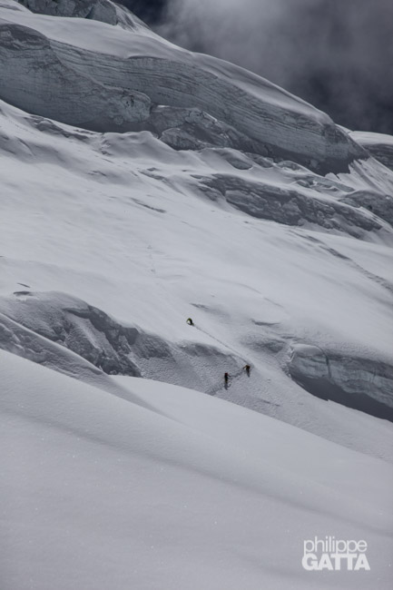
Once again we leave early to avoid the heat around noon walking in the slope. At 6,800 m we are at the base of the big serac which is roughly 20 m high with an overhanging end. We use the fixed ropes put in place by the Russian team. Later on, a new route has been open further to the left of the serac which is less steep. Our Sherpas refuse to go beyond the serac, so we have to do two round-trips to carry our gear to the camp 3 that we put at 7,000. Unfortunately we have only one stove and not enough food for 5 people so we eat only one soup and a couple of biscuits for dinner.
Climb: +690m / -125m. 4h10.
May 1: C3 (7,000 m) - C2 (6,400 m)
We had a bad night; it’s cold, -17°C in the tent, it’s very windy, my O2 saturation is only at 65% and I didn’t drink or eat enough. We share a Porridge for breakfast and we only have one powerbar left. Gorgan, Ben and I have no choice but to go back down to C2 where we have more food. Ludo and Alexia have a bit more food and decide to stay two more days.
The wind, which has blown this night, filled up the trail and we are very cautious on the way down as the slopes are very avalanche prone.
Descent: +0m / -600. 2h.
May 3 to 12: waiting game at BC and round trips at 6,000 m
The rest of the porters brought all the gear while we were up in the high camps. Now we have the generator, the PC and the satellite modem so can can communicate and receive the weather forecast.
Alexia, Ben, Ludo and Gorgan have decided to go down to Ramche and spend 4 days there to recover. Jean-Marc, Régine, Cédric and I prefer to stay at the BC. It takes me two days to recover, then I make round trips to 6,000 m every other day to stay fit and acclimatized.
During this period Dawa, Phudorjee and Tendi are carrying the rest of the loads to Camp 3. Pemba who arrived in BC late with the last porters is going up as well to acclimatize.
Everyday we carefully look at the weather forecast, hoping for 5 days of good weather to go for the summit. Unfortunately when it’s not snowing, the wind is blowing too hard.
After a few days, the Sherpas team comes back down. The camp 3 has been moved up to 7,200 m and everything is ready but nobody has reached the camp 4 yet. That means we will have to carry the gear and make the C4 as we go for the summit push.
On May 10th,Alexia, Ben, Ludo and Gorgan come back from Ramche, and Régine and Cédric are back down from their second acclimatization trip. Like all other teams, we are all at BC ready to go for the summit.
On the 12th, a weather window is confirmed for the 13-18th. So we plan on leaving the 13th to climb straight from BC to C2, rest in C2 one day, then continue to the C3 on the 15th, go to C4 on the 16th and summit during the night of the 16-17th, then go back down to the BC the following day.
Training climbs to 6,000 m : +490m / -490m. 2h.
Heart Rate (climb): average: 141, min: 110, max: 153.
May 13: CB (5 475 m) - C2 (6,400m)
As planned we climb straight to C2. Despite the previous load carries our rucksacks are still heavy as we bring more clothes and food.
The climb up to C1 is going well (3h30) but the traverse of the plateau up to the C2 is a nightmare. It’s extremely hot, there is no wind and I’m very slow. It takes me two hours to go from the C1 to the C2 that I reach totally dehydrated.
May 14 and 15: waiting at C2 (6,400m)
We spend two days waiting at the C2, two more days without getting out of the tent. New disappointment when we heard the latest weather forecast; now they forecast high winds for the 18th and snowfall starting on the 19th, perhaps the beginning of the monsoon. In addition the forecast has been unreliable the last days so we are more and more skeptical. Anyway, we do not have many choices; we are running out of food and gas so we can’t wait any longer here and even less go back down to make a second attempt later on. So we decide to keep going as planned.
May 16: C2 (6,400m) - C3 (7,100m)
We climb to the C3 without problem; the trail is good and the new route to pass the first serac is easier. The view from the C3 is amazing. In the meantime our Sherpas went up to the C4 at 7,550 m. Once again the weather forecast changes. It’s now clear that the wind will be too strong on the 17th so we have to spend another night at C3 and delay our summit push.
Climb: +710m / -45m. 4h.
Heart Rate (climb): average: 145, min: 116, max: 180 (while climbing the serac).
May 17: waiting at C3 (7 100m)
At the end of the night we measure -20°C in the tent. Outside the wind and the snow are raging and our moral goes down. A few hours later the wind has stopped, it’s sunny outside and the temperature rose to +35°C in the tent. The moral goes back up. More than 50 degrees of variation in a few hours is hard to stand. In the afternoon the weather deteriorates again, this weather is crazy and plays with our nerves. Whatever, tomorrow we climb to the C4 and we will see from there.
May 18: C3 (7,100 m) - C4 (7,550 m) - Kangchenjunga summit push
At sunrise the camp is in the cloud, the visibility is null and it’s windy. We decide to wait for better conditions to climb to C4.
At 9h, the sky clears up and Ludo, Alexia and Ben leave, shortly followed by Gorgan and me 45 minutes later. I catch up with Gorgan who does not feel good.
In the big seracs, we met Régine who is going down. She is too sick to continue.
I feel better than the previous days and I catch up with Alexia and Ben. I reach the C4 in just 3h10. Ludo is already there, once again he has been the fastest – even in breaking trail. Gorgan arrives 4 hours later, he feels okay but understands that he’s a bit too slow to safely continue to the summit.
We spend the afternoon resting and eating a little bit. The other teams have decided to delay their summit push from one day to have better weather conditions. That means we will be alone for the final ascent.
At 20h I start preparing myself, the wind is blowing and it’s cold. My oxygen saturation is very low, only 54%, but amazingly I do not feel too bad.
At 22h Alexia, Ludo, Ben, Cedric, Phudorjee and Tendi leave, all without O2. Twenty minutes later I leave (O2) too, followed by Dawa and Pemba. Finally Alexey Bolotov has decided to follow us and leave a bit later.
Climb C3 – C4: +465m / -21m. 3h10.
May 19: Summit du Kangchenjunga (8,586 m) - C4 (7,550 m)
Midnight, the wind has stopped but the sky is covered, it’s snowing a little bit and there are some lightnings further away. Ludo and I are hesitating to continue but as it is not too cold, we keep going.
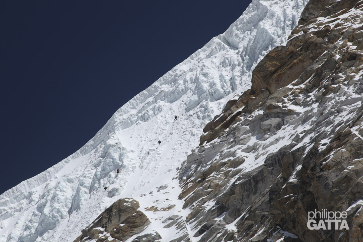
At 2h we are just over 8,000 m and we progress at 120 meters/hour. We are half way up the Couloir which is steeper than what it seemed to us. Phudorjee is climbing first, breaking the trail. He and Tendi are now using Oxygen. The quality of the snow is often changing, overall it is soft and deep, which makes breaking the trail exhausting, but sometimes the snow is much harder.
3h30, 8,180 m, from inside the Couloir, it’s not easy to figure out where we are in the Couloir and where we should leave it to start the traverse to the right. Alexia, Ben and Pemba are on oxygen too. I’m in front with Phudorjee, Tendi and Ludo is right behind. Phudorjee and Tendi go straight into a steep mixed terrain. That doesn’t seem right so I go to the left and climb 80 m in the Couloir. Breaking the trail is a real pain. That pays off as I find an old piece of rope.
Then I see a steep gully leading to the traverse. Ludo joins me, as well as Phudorjee and Tendi who are getting back in front of us. Dawa is right behind me and Cedric is following us further down. From this point on, we climb together all the way to the top (but unroped). At this point, I haven’t realized that Alexia, Ben and Pemba have turned around.
The traverse which looked as an easy slope on the photos, is in fact harder, more complex and much longer than expected.
After the traverse, there is the “hard wall”, once again we are surprised by the route; I was expecting 1 or 2 steep pitches but in fact it’s much longer and mixed.
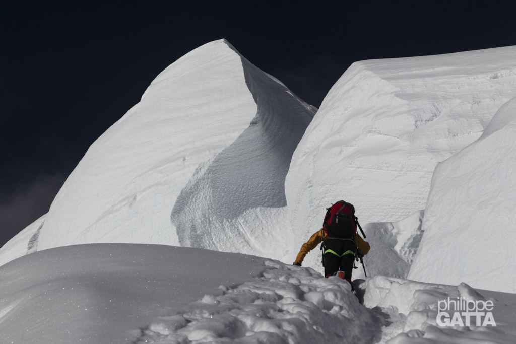
At 6h we are at 8,440 m at the bottom of small rocky tower, breaking the trail and the mixed climb take forever. Above, the snow ridge is easier but the snow is deep and not very stable. I go first a few times but give up quickly and let Phudorjee taking over. We are still very slow but fortunately the weather is steady; there are some high altitude clouds, some lower clouds as well but no wind. Then, the following 100 m are on mixed terrain again with some technical and physical sections (like the Chimney). Overall the climb is not extreme but never easy.
We finnally reached the summit of Kangchenjunga at 9h10, after 11 hours of ascent. We stay 10 minutes and start the descent.
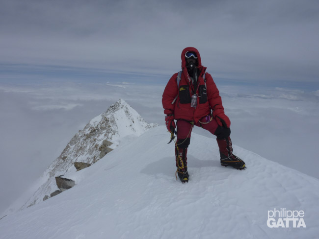
Phudorjee (O2), Philippe (O2), Ludo (without O2), Dawa (without O2) and Tendi (O2) reach the top of Kangchenjunga at 9h10. Alexey Bolotov (without O2) arrives a few minutes later. We are the first ones to summit the Kangchenjunga this year and that is the first French ascent in 27 years. There are two layers of clouds and a very few peaks are visible.
Later on, we pass Cedric when we climb down the Chimney, he will reach the top at 10h (without O2). Then we cautiously climb down the 300 m of mixed and we reach the Couloir at 10h30. Overall, the weather has improved, it’s now warmer and the snow in the Couloir has tranformed. We pass a Russian climber who left very late, he will reach the top alone at around 15h. Phudorjee passes us on the way down and we arrives first at the C4. He has been the strongest climber today, breaking the trail in most of the route.
I reach the C4 around noon, followed by Ludo and the rest of the team.
We spend the rest of the day to rest and eat but at 7,550 m it’s hard. My oxygen saturation is below 60% and I do not feel so good.
Ascent: +1050m / -1050m. 13h40.
Heart Rate (climb): average: 134, min: 106, max: 148.
May 20: C4 (7,550 m) - BC (5,475 m)
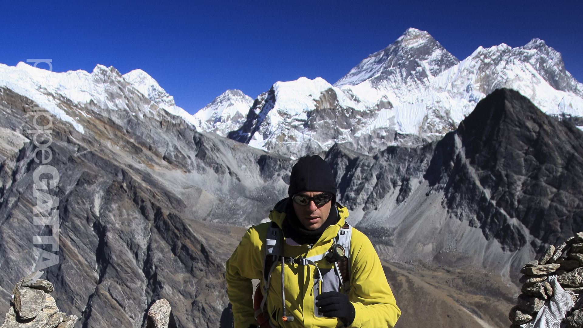
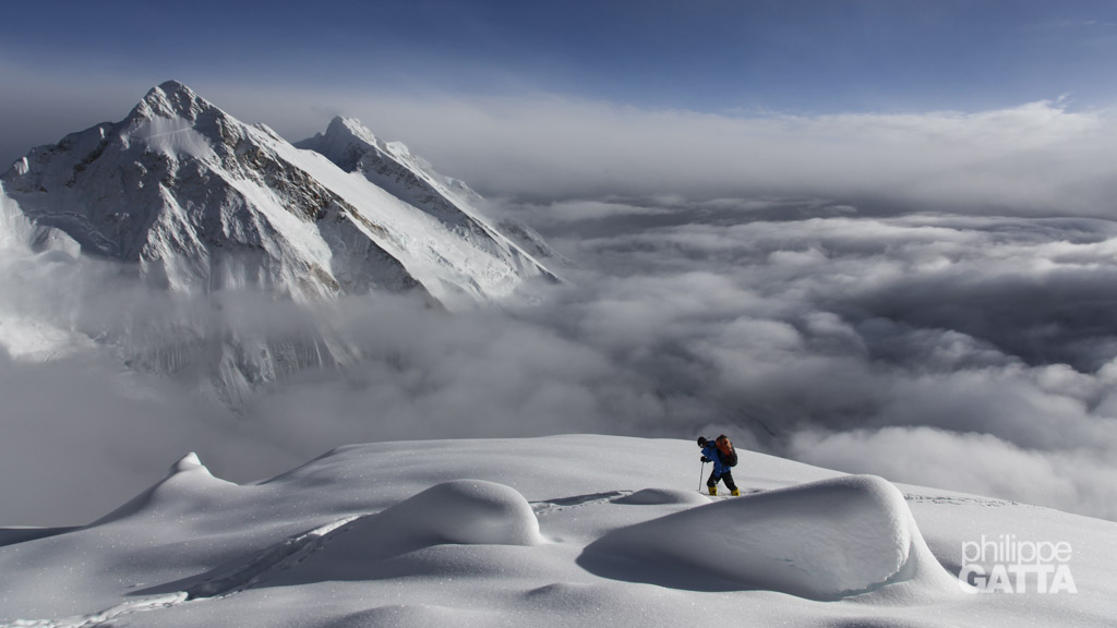
Ludo and I leave the C4 at sunrise. It is cold but the weather is perfect with an amazing view over Everest, Lhotse, Makalu, Jannu, Yalung, up to the extreme of Nepal and even the Sikkim (India). Some other teams are heading to the summit today taking advantage of the trail we broke yesterday.
Later we join Alexia, Gorgan and Ben at C2 who had an epic descent yesterday in bad weather conditions. Obviously we all carry huge rucksacks as we take down all the camps and gear. It is nice be back in BC after seven days spent in high altitude.
Descent: +95m / -2140m. 5h15.
May 22 to 25: BC (5,475 m) - France
At the breakfast this morning we could see the fatigue on every face. We are exhausted and we have lost so much weight that we look scary. The last 2 days have been rough; we climbed 18 hours skipping a night and then went down straight from C4 to BC yesterday, 2,150 m of descent in 5h15.
We will leave the base camp tomorrow so we spend the whole day to pack everything up and prepare the loads for the porters. We will do the same trekking that we did on the way up, but in 4 days instead of 10.
May 21: BC (5,475 m)
The trekking back went rather well but has been really hot at the end. We made four stages: CB – Tseram, Tseram – Yamphudin, Yamphudin – Doban and Doban – Tharpu.