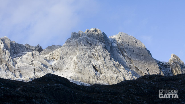
CARSTENSZ PYRAMID (4884 M / 16,024 FT)
WEST PAPUA, INDONESIA
Carstensz Pyramid (Puncak Jaya), 4884m (16,024 ft)
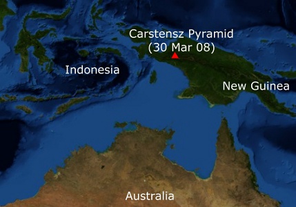
Carstensz Pyramid, the highest mountain in the Pacific Basin, is considered the tallest peak of the seventh continent (Australia/Oceania) for climbers attempting the Seven Summit. Located in the Sudirman Range of Indonesia’s Papua province (island of New Guinea), it is the highest point between the Himalayas and the Andes, as well as the world’s highest island peak.
The mountain was first sighted by Dutch explorer Jan Carstensz, and it was named Carstensz Pyramid after him. It is also known as Puncak Jaya. In 1962, Heinrich Harrer, Temple, Kippax, and Huizenga became the first climbers to summit the peak.
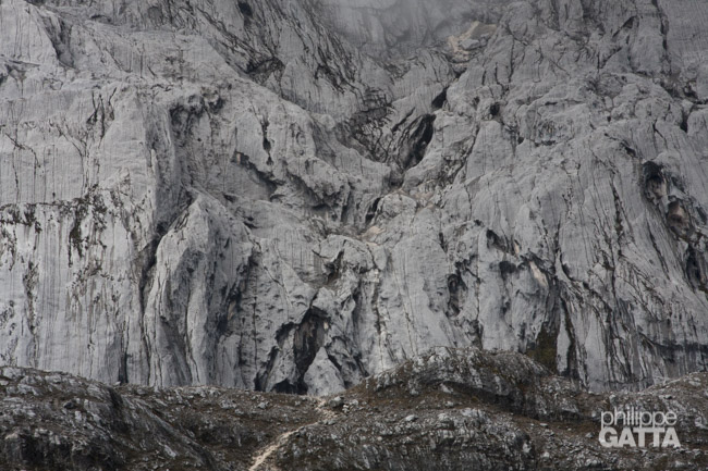
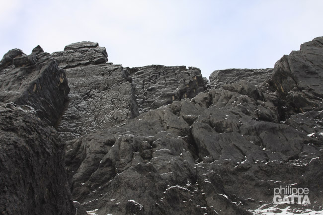
Most of the Sudirman Range has easy terraces, but Carstensz Pyramid’s north face comprises sheer 10,000-foot cliffs with an extensive ice wall glacier.
The climbing route on Carstensz Pyramid involves a series of gullies up the north face for 500m (1,640 ft) of solid rock before breaking out on the ridge. The summit ridge undulates for half a kilometer, with notches throughout. The descent requires rappelling and downclimbing for most of the way. The rock is rarely loose and provides good friction, even in wet weather, with a difficulty level of up to 5.10 for short steeps.
Temperatures on the mountain can range from -3ºC to 15ºC (25-60º F), with occasional sunshine in the mornings, followed by rainfall or snow in the afternoons and evenings. Wind conditions can vary but may be strong.
Lake at Carstensz's base camp
Carstensz Pyramid Expedition
March 30: Base Camp - Carstensz Summit - Base Camp
At 3am, we wake up to light rain and a temperature of around 5 ºC. Due to the humidity, I dress for the cold similarly to when I was at Vinson base camp in -20 ºC.
By 4:30am, we begin our ascent. We climb 100m to a pass l and then descend into a small valley.
Along the way, we pass several lakes before reaching the bottom of Carstensz’s wall at 4350m, which is at 5:30am.
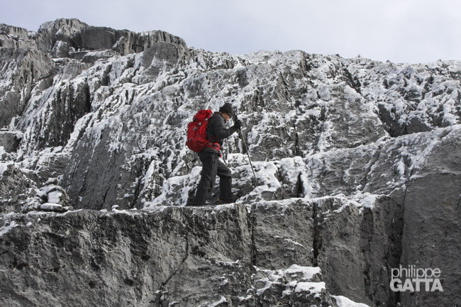
After the rain stops, we put on our harnesses and helmets, leave a pack behind, and begin the climb. I lead the way, followed by Angelo and Danny, with fixed lines in place.
The first pitches
The first three pitches are steep but not difficult (as seen in the photo below), with quite good quality and very adherent rock, even when wet. At the top of these pitches, there is a shelf, followed by 50m of scree and easy terrain.
Beyond the scree, there are two to three pitches of slabs (at a 60-degree angle) and gullies where water pours down.
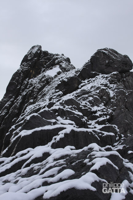
Beyond those slabs, there is another steep scree for about 40m, which is covered by 5 to 10cm of snow, making it a bit slippery.
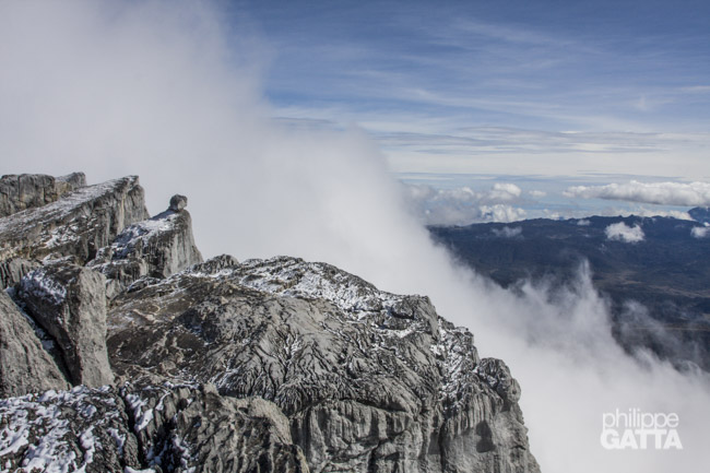
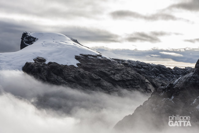
Fortunately, the clouds clear up, allowing us to have a fantastic view of Ngga Pulu (4862m), the second-highest summit in Oceania. We also get a clear view of the ridge and the Tyrolienne from this point.
After the easy section, there is another steep pitch that leads to the bottom of the final wall. However, I make a mistake and traverse to the left too early, causing us to waste time and energy before finally reaching the bottom of the final wall.
This wall is 2-3 pitches high and quite steep, ending on the ridge just to the left of a big, obvious tower. We have to switch gloves as the first pair is completely wet.
Final ridge
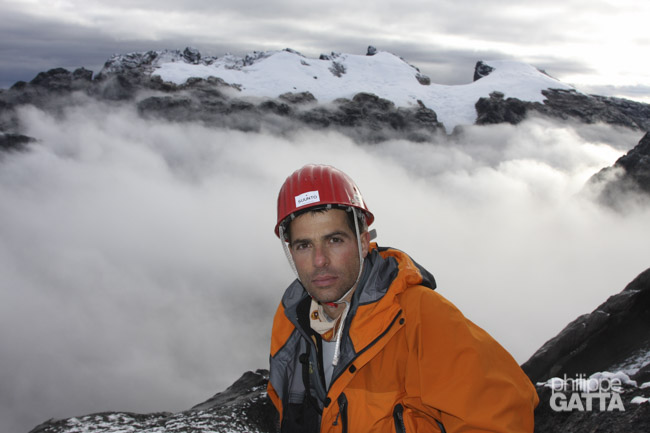
At 7:40am, we reach the ridge (4745m) and finally catch a glimpse of the South face of Carstensz and the forest beyond. However, the clouds quickly return.
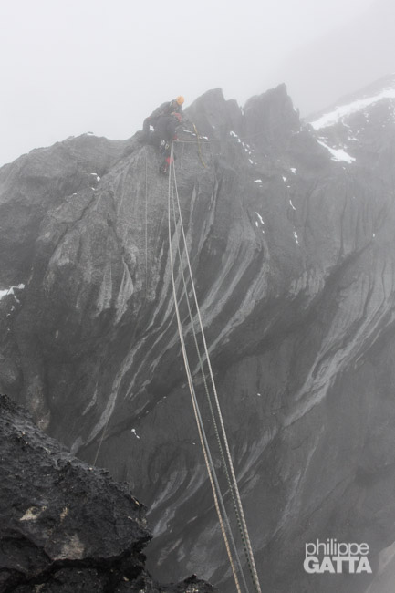
To cross the gap, we opt for the quickest option: the Tyrolienne. Alternatively, we could rappel 8m, cross 10m, and climb 10m on the other side. The entire section of the ridge is covered in snow or ice, and each of the four ropes on the Tyrolienne has 2cm of ice along the way. It takes me at least 10 minutes to break the ice as I go.
Although the Tyrolienne is the longest crossing, it’s not the only gap we encounter. There are two other gaps where we have to climb down and then up along the ridge.
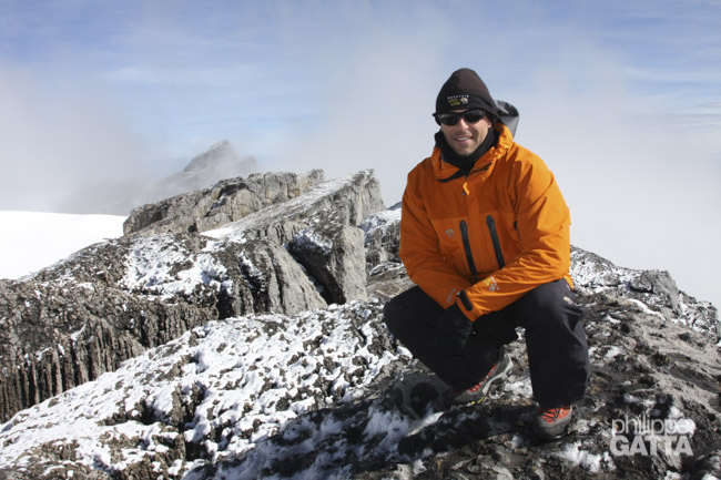
A final section on the South face leads to the summit that we reached in 3h from the bottom.
We are in the clouds and see anything, a Carstensz standard I guess.
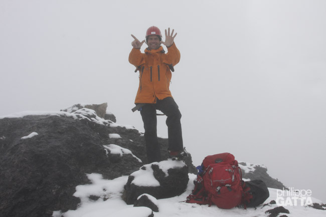
We reached the top in 3h from the bottom. This is for me the last of the Seven Summits.
The weather deteriorates as we start the descent.
We climb down and rappel the 500m of face in 2h30 and gently come back to the base camp.
Ngga Pulu, 4862 m (15,951 ft)
Ngga Pulu (also called Ngga Poeloe) is the second highest peak of Oceania. It is just 22 meters lower than Puncak Jaya (Carstensz). We scaled Ngga Pulu the day after Carstensz. The climb starts from the same base camp and follow the valley toward the East. We reached the “chaos of big rocks” in 45 minutes, from there we turned left toward the ridge of Ngga Pulu.
After the ridge we followed the large slabs just East of the glacier.
We reached the top in 2h from the base camp.